

8:45 pm – recent MODIS map prepared by Adam Clark. Of concern is the southern block of red which is just about up to the Little Sur River.

8:30 pm – really?? I haven’t added anything since noon? I guess FB and official notices kept me busy. In any event, here are 4 photos taken at CV Airport by Lucas Ryan between 7:30 and 8:3o pm.


Noon: Currently four bombers are working Pico as well as the DC-10
BTW, as someone reminded me, did you remember to take your vitamins? I hadn’t and couldn’t remember when I did. I am also hydrating with iced tea right now, and Rock Knocker just asked me if I had eaten (I hadn’t) so he is making me a sandwich from groceries he picked up for me yesterday.
Some photos from Mescal Ridge last night provided but not taken byMichael Troutman


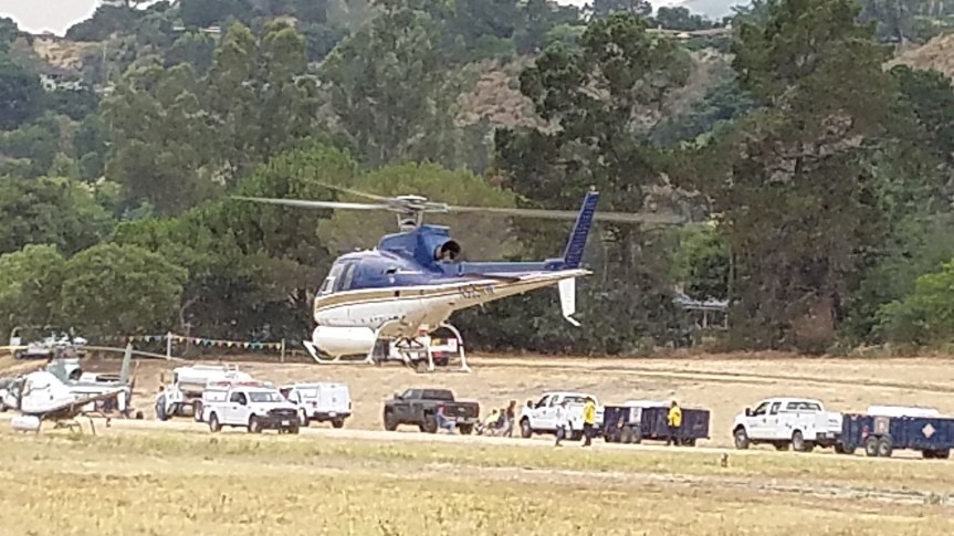
11:00 from the Deli RIGHT NOW

10:30 am – from Brendon Shave. The local is self-explanatory for locals, and even most regular visitors. Current conditions

8:30 am – Fire Line Plans for today from Highlands to Grimes Canyon – amazing information. I know they have over 50 dozers, but can they really do all this today??? Be ready, 12 different detailed maps I will hopefully get up in order.


topo map sent by John Chesnut

Also a couple of MODIS maps, also sent by John Chesnut (blue line is Sunday’s border)


7:30 am- a sweet little video sent to me by John Galt that is a wonderful way to start the daymand a great little reminder. Only 2 minutes. “I will be a hummingbird” Do yourself a favor, take two minutes out of an otherwise hectic day and watch it. Thanks, John;
7:00 am – Dawn Photos from Clear Ridge provided by Jen Smith


Left is south, right is north
4:30 am – it is getting harder to get any sleep during this emotionally trying event, but this sleeplessness is offering me the opportunity to explore other sources of information, and so I went to one of my favorite blogs for great info, maps, and photos, my friend, Keith Vandervere’s Xasauan Today site. His entry for yesterday, up through 10 pm, is full of useful data and insights. You can find him here: Xasauan Today. No one knows the backcountry like XT. You’ll want to bookmark this one.
Michael Selig posted some photos on a FB album taken at Green Ridge yesterday, 7/25, where he says his house is the only wooden one still standing. Try this link:
As usual, I will be updating these reports throughout the day, posting another simultaneously run Official Reports and Maps blog post, as well as a photography one.
Lots to do before sunrise comes. See you throughout the day.
Any info on Shirl.e Edmondson property on Greenridge?
Thank you Kate.
I guess we will sleep when this is over. Thanks again Kate for the dedication and information for the community.
I just told a friend who is worried about me the same thing! LOL. Looks like you got as little as I did. The difference is, if I can get back to sleep in the next few minutes, I might get another hour and I know you have to start feeding the troops.
Thank you, Kate, for keeping us informed. I start my day with your blog and end it with your blog.
Over here in Jamesburg (Tassajara Road) since the fire started we have lived in a gloomy smoke cloud. But awaking this morning the cloud has lifted. The air is clear of smoke and fresh!!!
May today bring better news for all of us.
Good morning Kate. Yah…sleep is overrated, right? Thanks for being present.
If people want a good wind prediction site that I have found very good when voyage planning on our boat check out Sailflow . Even shows an Apple Pie GPS dot on the map for us. Micah
I read yesterday that the Pico Blanco boy scout camp burned to the grounbd. Can anyone confirm?
I heard that from three different sources yesterday, but now I am hearing the campground burned, but none of the buildings. Hoping the later is true.
bigsurkate
Light easterlies & clearing. Time for some aircraft!
Hoping for the best for Camp Pico Blanco’s beautiful lodge and new climbing wall. Thank God the evacuation of scouts went smoothly and the kids that were scheduled to attend Week 4 of camp were re-routed to other camps the day *before* they were scheduled to arrive at Pico. Our boys received the custom camp t-shirt a few weeks ago… printed on the front is “Where there’s a will, there’s a wall”. Seems fitting for the times
About 20 trucks have gone up Robinson Canyon in the past 30 minutes including a large water truck. Several were marked “Trinity” and two trucks said “Hot Spot” on them. Hopefully they can save White Rock and this side of the hill. Thanks to all who are fighting this fire. Sad for all who live in this beautiful area.
A personal note to Kate…..you are FANTASTIC! Everyone I talk to is viewing your site! We can’t thank you enough for all you are doing to keep not only the Big Sur Community but the entire Peninsula and those connected to it informed. We celebrate you!
Just wanted to say thank you for all the excellent reporting, Kate. I’m Lisa K’s daughter in law, and while we were able to go down to Big Sur twice in the last few days, it is amazing to be able to get such detailed updates from SF where we currently are. Even my dad, who lives in Sacramento, found your blog and sent it to me! Thank you thank you thank you for all the work you are putting into gathering information!
Does anybody know if the fire has reached the blacktop/how close it is? The maps are really concerning…my family lives just below the fire station off the hairpin turn.
Folks, I left the canyon last night after taking many pictures and I also posted about what I saw. Please look at the final post from last night and you can see details about your properties. There is also a link to the pictures.
Note to Shirl.e Jones-edmudson, since I took pictures on the way to your property, and discussed the conditions at length, it might give you a better idea of what to expect regarding your property. I didn’t make it all the way to your property, but if your house was stucco, there is some chance it survived. Any structures that were wood were gone. Again I can’t confirm your house because I was on foot trying to take as many pics as possible…but take a look at the pics and post.
Which blacktop? What hairpin turn? Hasn’t touched highway one yet
The part that’s paved up palo colorado canyon, we’re the last house off the pavement.
Here is a link to the pictures on Capra’s facebook page. Friend her and you can see the pics. https://www.facebook.com/capra/media_set?set=a.10157491901135144.1073741835.571140143&type=3
Great maps Kate, thanks for posting those! Quoting Ivy, “gofirefightersgo”!!!!
From Jim, via Andrew Hall
Everything is holding, he thinks no homes were lost overnight!
It took a run last night in the farther back of the canyon – went through pico and heading up towards arroyo seco and heading up into little sure water drainage.
Green ridge and longrdige – Matt is saying btw 30-35 homes lost
Heard a transformer blow, and guys were sitting down below couldn’t see through the eucalyptus
Took the guys up to his deck to show, all these guys trucks are sitting here doing nothing.
The guy said – well its not in my section. Jim: Well radio to whoever’s section it is!
Tell them its the dowery residence..
Later a blm guy showed up and asked – how do i get up there? Can you get a truck up there?
Jim: go up to king road, response we are scared but listed the vehicles they have. Jim told to take the smallest and then come down the fire break, took type 3 vehicle
A crew went up and the structures are okay!
Last night they laid in at the bridge going to matts. They laid 8 miles of hose but the fire rolled down and destroyed some hose.. some was okay but some didn’t hold.
Winds are supposed to change – hopefully it will push itself back in and burn out
SMOKE IS SO BAD its burning your eyes and can’t get any air support
~ Andrew
freestyle89@gmail.com
My mom sent me this, sounds like my house is be ok…too close for comfort. The answering machine isn’t picking up anymore. Thanks everyone for the information, Kate this blog has been an amazing resource:
A neighbors story at midnight last night:
Sofanya White to Big Sur Friends
I rec’d this message from a friend who was in Palo Colorado today. This is someone I respect and trust:
” wanted to give you a heads up that as of today 5pm your home was untouched….. I drove up to the Mid Coast fire station….. and most if not all of the homes from Hwy 1 to the station that I could see from the road were untouched by fire. However, the firecrews were on the ridge above the station battling the blaze and some houses were being lost as I watched – what a horrible experience…. I do not know if the fire was expected to come down the canyon. the Dome was fine….. I am heading back tomorrow….. and will check again…..
next message: my feeling was….. that the fire crews would make a stand at the station and that any thing on the road from the station down would be ok…..unless something came from up the roadway…. that was just the feeling I got from the crew on site….. the guys were up in the hills trying to save houses but while I was there at least 2 were burning behind the tree line in front of the fire station…. helicopters were dropping buckets of water but I fear it was too late… pray for no fog tomorrow so the planes can fly and drop retardant….. we need a few full fly days to get the fire line in hand …if that doesn’t happen I fear for a much bigger fire. they can’t fight it on the ground…. I’m going back tomorrow – I’ll give you another update….. maybe the fire on the ridge will have created a firebreak…..
Next message: they have water tender trucks (a number of them in a couple of locations along palo canyon rd) to be able to quickly fight a fire if needed…..
Hi all –
I am a former Pico Blanco Camp Director, still involved in Scouts locally and a member of a couple committees that work on the camp facility.
First – the camp has NOT burned at all. There has been fire activity along the road and at the public campground below Bottcher’s Gap. The fire has not – I repeat has NOT – reached the camp itself.
Second – this is clear from satellite heat imagery readily available online.
Third – the camp has been systematically undergoing a massive fuel reduction program for several years in cooperation with CAL Fire. If you haven’t been into the camp in a while, it will surprise you.
Finally – please help us with rumor control. We worked very hard to bring back camp and camp programs after the Basin Complex fire. And it took nearly five years to convince people we were still open for business because of rumors. Please do not propagate false information. It scares people and hurts the camp.
Thank you.
Matt, I am going to post your note to clarify for people. If you want me to take it down, message me at tarawings on gmail or Facebook. I’d ask permission, but I don’t have your contact.
Hey all, regarding pictures of Greenridge road, they are on my Facebook account as I didn’t know how to get them to Kate for the blog (Kate feel free to repost any here if you want to download them from FB, I made sure they went up high resolution). I am responding yes to all friend requests today even if I don’t know you, as I will assume that you are trying to get a look at yours or friends’ properties. Please be sensitive in your comments, as many people lost everything they own and some their livelihoods as well. I will remove any inappropriate comments as I can, but I’m also working today so try to just do your best to be good to your fellow humans.
The Boy scouts’ Camp Pico Blanco has NOT burned. Check thier FB page for updates: https://m.facebook.com/CampPicoBlanco/?tsid=0.7024529653135687&source=typeahead
Thank you, Rock Knocker, for taking such good, good care of our Kate!
He just left, Jeff, but yes, he is checking on me. I am taking the day off Thursday to take him to /River Inn for his birthday lunch. It’s tomorrow, but I have someone coming, so have to do it a day late
bigsurkate
YES, I agree, thank you Rock Knocker for caring for Kate, she is important to the world, the universe, and clearly to you too. Prepare for sainthood.
xxoo
Unfortunately, and I have it on good authority from a person who stayed and is well respected, it appears that everything on upper Greenridge except for Tanya’s house is gone. I lived on Greenridge years ago and I am hard pressed to recognize anything in the pictures posted by Mike.
I’m hoping that the city of Pacific Grove will cancel their fireworks for Fri. night since we don’t need more smoke and fire around here.
Sorry, I meant Sat. night July 30th.
Just received notification via KSBW that San Carlos Ranch between Canter Run and Garzas Trail is now under evacuation order.
Your comment and my new post must have crossed paths in cyber space.
Feast of Lanterns Fireworks…I’m sure there will be varying opinions about how appropriate it is. Something to keep in mind is the chance it will afford for the community to come together, providing a real, all-too-rare, 3-D space for people to talk that isn’t virtual. This can only enhance the network of support which has already begun through various organizations and this amazing website. There few opportunities or venues for people to gather and talk, and The Feast of Lanterns couldn’t come at a better time in my opinion. Fireworks or no fireworks, there are other activities throughout the week, and supporting community activities would be a beautiful thing amidst the haze of a tragic week and weeks to come. I am not in any way affiliated with the Feast of Lanterns. Just a member of the community feels the need for very large communal embrace. I have messaged The Feast of Lanterns on Facebook about the fireworks Saturday night and if I get an answer, I’ll post it.
Felicia: In upper greenridge Tanya’s, Vic and Andrea Cooper’s, the Colb’s place and ours had survived as of yesterday evening when Michael left. Ours could very well still burn or might have last night, though most of the fuel leading up to it is gone. I am curious if your person on the ground has more recent information. Tanya’s appeared to be the only thing up that driveway when Michael hiked up, but he also didn’t make it all the way to the top, and I have heard from some neighbors above her wanting to know if their place survived, and I could not give a definitive answer. There are a few other places tucked in that we don’t know about. I don’t want to unnecessarily alarm people unless we know for sure their place is gone from an account such as Christopher William’s. Things definitely look bleak for Upper Greenridge.
I just do not know at this time
bigsurkate
Any news of the Moon property (John and Susy)?
The person I got the info from was basing it on what they saw along with what a few others saw and told them, including some out of area firefighters, hence the word “appears”. I do hope they were wrong, there were some very beautiful trees and homes there. We both wrestled with this post for a while for obvious reasons. Contact in the canyon is hit and miss so I haven’t been able to talk to them since this morning and get more info. Hopefully that will change. So glad to hear some folks were pleasantly surprised! 🙂
Air Quality in Carmel Valley very low –
Robo Calls going out from “Reverse 911” – here is info:
– Avoid being outside, particularly exercising outside. Keep kids, pets in.
– Avoid vacuuming (stirs up dust)
– Avoid burning ANYTHING (candles, incense, cigarettes, wood fires, etc.)
– Avoid smoking (hurts your lungs, and those around you)
– If you have a HEART CONDITION or CHRONIC LUNG CONDITION – check with your doctor to get their advice – and make plans to stay inside close to an air purifier, or consider leaving the area.
The point: lungs like clean air.
If you can smell smoke, the particles are hurting your lungs.
(Oh my gosh! What is it doing to our brave firefighters???)
As of 4 pm, Home Depot had 5 air purifiers left.
REGISTER FOR “REVERSE 911” – easy, just Google it, and sign up.
A nice robot lady voice will call you too.
In the Fire Line Plans maps, on the legend (and maps) there are marks for ‘Division’ and ‘Branch’. Does anyone know what those marks mean?
Great job on this site, Kate.
If you are talking about the back-to-back reverse parentheses marks, those denote the beginning and ends of the respective Divisions and Branches.
Thanks for that, Kate – I still don’t quite understand. Are these geological terms, say a ‘division’ or ‘branch’ of a creek or a valley?
No, no, no, no think war – a division of troops, a branch of troops. They use the war model to fight these fires.
bigsurkate
Aha!! That is helpful! Thanks. I’d been googling “divisions and branches on topographical maps” and getting pretty confused.
I add my thanks to that of many, many others on your own work, Kate. I’m up in Carmel, visiting from Pittsburgh for the month. We have family out here with long roots in the area, and are heartbroken at the fires, and so thankful for all the people fighting it. It is inspiring to see – and in this we ran into your blog. You are far more than your ‘little hummingbird’! We loved the analogy. thanks for what you do for the land and the people.
Kate, Thank you from Cachagua–I’m totally in awe of your indurance and dedication
The Pico Blanco boy scout camp did not burn at all, it’s A-ok, but the fire is close tonight
Yes, a former Scout Master and host or whatever at the campground posted to my Blog, so I knew it didn’t burn, and am very sorry I passed along unverified information. It is hard to get things verified when status changes so rapidly
bigsurkate