


10:30 am – Per Greg Fain at Tassajara Zen Center, there was no IR map last night as the pilot was sick. John Chesnut writes: “Attached is a map with a revised perimeter based on the OPS Branch VI topo map — hand drawn on GE. [Google Earth?] The OPS map has fire to the crest above Willow Creek, but not down the south bank slope. Fire to edge of the lower Lost Valley Creek, but not across up the north-facing south bank. Fire comes down an un-named drainage on the east to very near the Arroyo Seco.”

8 am – John Chesnut says: “No new perimeter for Sunday is on the Fire server. I check back after 10 or so. The VIIRS satelllite is current however (2 AM overpass).
The Radio chatter called in new air attack yesterday due to the spotting towards Arroyo Seco, so this is the best I can do on the spread toward that drainage.”
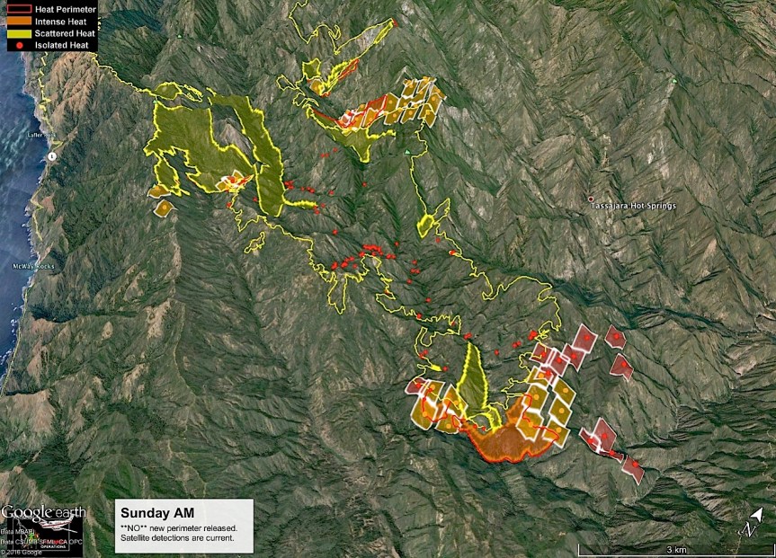
7 am – still no IR Topo Map, but here is the briefing map in screen shot, with a link to the original. I did find the acreage for today on the progression map – it is 105,642 for an increase of 1795 acres.


And an evacuation status map for today:

5 am – many of you will be reflecting on 15 years ago on this date, and I honor that. I will be focusing on what is happening here … Now …
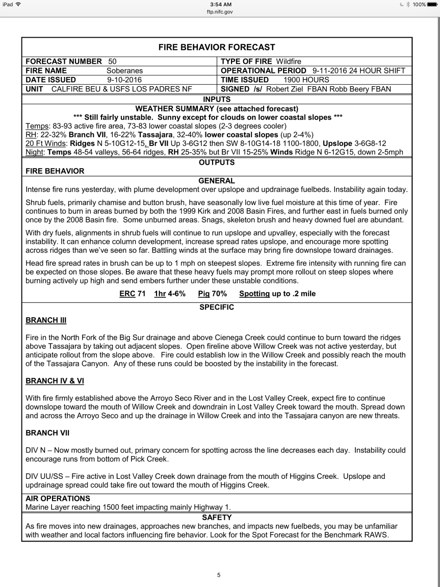
Given the run to the south east yesterday in the Willow Creek (East) drainage and the mandatory evacuation of Tassjara from Chew’s Ridge South, and the evac warning for Tassajara Road from Chew’s Ridge North and Carmel Valley Road east to Arroyo Seco, I was anxious to get up early and see the fire’s progression on the morning IR Topo Map, but no such luck. As of 5 am, it is still not posted, or not to be found. All the other information is available, but without this map, most of the rest is of no assistance because there is no frame of reference. I can add today’s fire behavior and weather predictions discussions though, and then I will come back in a couple hours and check on the IR Topo map again.

Kate, if you go to
https://sartopo.com/map.html#ll=36.20524,-121.55782&z=13&b=ter&a=modis
In right hand top corner, you can choose settings. I usually choose terrain and current fire activity.
You will see the latest heat reading by the satellite at 00:35 MDT (is this mountain daylight time?)
Looks like the fire is kept at a safe distance from Tassajara while traveling right south of it to the east. It is almost encircled by 1/2 circle now at about 2 mile radius.
This fire is really starting to get to me, to the point of wanting to cry, thinking of the creatures having to run for their lives and burning to death. We, with all our stuff, are being spared, they are not and it is their home!!!!
Thanks, Regine. While this is somewhat helpful, the IR Topo is based not on satellite, but on an actual Infrared mapping flight. The provided map gives the current acreage from which to figure out the amount of additional forest lost in the last 24 hours or so, a valuable piece of information. Thanks for sharing this site, though.
bigsurkate
many many thanks for continuing your work… we really appreciate it!
I never envisioned this would be almost my entire life for 2 months or longer, though.
bigsurkate
Hear, hear. What I do like most about this map is that it updates 2 times a day and before we get the daily maps from the fire agencies. Patience is not my best virtue.
Also, I don’t like that fire finger near S. Ventana Cone pointing NE.
no one did but you are serving right beside our fire fighter heroes….
We’ve had lots of low-pressure fog down here in San Diego the past few weeks. I am surprised, if you guys are getting it up there too, that this has not put the fire out yet. The Cal-Fire and other reports have not changed from 60% contained for over a month now. Being a veteran of huge fires down here, once the weather changes and the marine layer rolls in, some of these fires tend to dissipate rather rapidly.
Do you have any idea what portion of the state parks (Molera, Big Sur, Pfeiffer Burns) have burned during this fire? What portion of redwoods?
Just curious. A real bummer that this things is still burning. It pisses me off big time. God help us all with the vagaries of climate change and population increase.
Chris
Thanks for the PDF links, Kate.
Chris, Molera has not burned, it is a staging area. The Pfeiffer Big Sur State Park area burned in the eastern and southern hiking portions but not the buildings or campground – came right up to it, though. JPBurns burned in the back country only. The fire came right down to the highway in only one spot near Fernwood in Big Sur Valley, so far. The fog here generally doesn’t get much above 1-2K feet, and stays pretty much on the Coast. However, much of the fire is inland and above 1-2K where it is hot and very dry. Winds due to pick up tomorrow and Tuesday, so could be for more spread inland.
Chris- the fire is moving now into my favorite areas of the forest- the Arroyo Seco drainage in particular. This part -the eastern part of Ventana Wilderness- very rarely sees the coastal marine layer. In fact the type of weather we are seeing is the norm for this area- except insofar as fire creates it’s own winds. As a general rule the moisture decreases rapidly from about June until the first rains of the season. Every summer the USFS routinely bans campfires outside campgrounds. This year those restrictions went into effect on June 14. Fire is also a normal part of chaparral ecology in that it clears away dead brush allowing for new growth, with the resulting increase in food supplies for the animal population,etc. In fact this is one of the rationales for allowing fires to continue in forests – concentrating resources on the obvious structure protection and distant fire lines. Of course the inaccessibility of the terrain makes it very dangerous for firefighters too. Both play a big role.
In terms of fire behavior the heat from the advancing flame front dries and pre-heats the foliage in front of it. On upslopes it can cause those runs you see mentioned in the status reports- especially when winds are favorable.
What really infuriates me is the number of these fires that are caused by people who go into the wilderness with no respect for the forest or knowledge of the state of it. It’s not like the dry state of the brush is any surprise this time of year-even in wet years. Hopefully they will catch those people who started the illegal campfire like they did those who started the Indians one.
Kate – no matter what time I go to bed, or get up, your site is the first thing I read. Thank you for staying on top of the fire/s! Even though our area (CV Village) is pretty much out of the way of the Soberanes Fire, my heart is continually focused on exactly what is happening with this – although natural – most horrific event – that just won’t seem to stop. A few weeks ago, my yard was overcome with dozens of new life forms, furry and feathered, and I wiped away tears of both sadness (for the sweet creatures who didn’t make it out) and joy (for these few brave souls who did make it out!) As others mention, it’s almost too much to bear – not just the wilderness that we love and that opens our hearts, but all the life forms too….it certainly has affected me deeply and transformed my priorities. I find that I don’t rush conversations as much these days, I take a bite of food, and close my eyes to really taste it. With the huge loss of life on a daily basis all around us, I can’t help but grieve deeply, and also feel grateful for what I have. It is all so temporary, and so easily taken away. I hope that besides the anger that people feel for the fact that this all started by a HUMAN, that we can also realize that we are all flawed in some way/s, we are all HUMAN and we are all here to love one another in the short time that we have. Sure hope this doesn’t sound “preachy” – something about today’s posts by others inspired me to write this. I’ve never experienced being this close to such a long-term and horrific event of such magnitude and devastation – and the fact that it seems to have “no end in sight” – well, I don’t know how you – and the valiant, amazing fighters – have the energy and strength to go on day after day – I am worn out, and I am merely watching from the sidelines! God bless all the people, the animals, the plants, the trees, the reptiles, birds, and millions of life forms that are affected and devastated by this fire. I am grateful to have your site – to read others’ comments, incredibly up-to-date info, and to commiserate and share. It makes me feel I’m not alone as we go through all this. Thank you so much for your heart.
The maps are showing Milpitas Special Interest Area to the south of the fire perimeter now. What is that?
Hi Kate- just a few quick notes for those unfamiliar with the general lay of the land.
Tassajara Creek trends SE from the hot springs for roughly a mile then does a sharp turn trending eastward to the Arroyo Seco River (itself trending north) on the east side of the maps. Willow Creek drains into Tassajara Creek at the eastward turn. This area is readily apparent on the maps as the long “gash” south of Tassajara Zen Center.
A few miles further south where one of your maps has Deer Pasture labeled- ZigZag Creek drains into Lost Vally Creek on the SW side of Deer Pasture. Higgins Creek also drains into Lost Valley Creek a mile or so SW of Deer Pasture. Lost Valley Creek itself also drains into Arroyo Seco River- right about the most SE extension if the fire perimeter on the map.
The incident objectives state the goal of keeping the fire within the Ventana Wilderness. That implies that they will be making some major efforts along the Arroyo Seco Road on the center of the briefing map. Branch VI- Div II and GG.
Keeping my fingers crossed.
Thanks for the clarifications for my readers. It really helps.
Here is what the VWA has to say about the Milpitas Special Interest Area:
“In the Los Padres National Forest Management Plan of 2005, the Forest Service recognized the unique aspects of the area and designated the Milpitas Special Interest Area (SIA). The SIA contains a cultural landscape reflecting a continuum of Native American occupation from prehistoric through historic times. Besides the archaeological significance of the area, the valley oak savannahs and sandstone outcrops have become field laboratories, regularly studied by scientists and universities.
The Milpitas SIA contains approximately 9500 acres, located in the upper watershed of the San Antonio River, much of which is within the Ventana Wilderness. It is approximately 17 miles from Mission San Antonio near the border of Ft. Hunter Liggett. The dominant feature of the area is Santa Lucia Peak (Junipero Serra Peak), at almost 6000 ft., the highest peak in the Santa Lucias.
Prehistorically, the SIA was inhabited by the Salinan people. After the secularization of the mission in the 1830s, many of the mission Indians returned to their ancestral lands. The community became known as The Indians. The name Milpitas, is derived from the small gardens or farms that were planted.”
Thank You Kate. As others have said, yours is the first email I read every morning and every evening. Bless you, bless you for all you do for our community and those who have an interest here. I have no idea what the people closely effected by this fire would do without you. Much love to you.
I spent many days up on Chew’s Talking to dozer people, and fire captains. They spent a lot of time creating massive fire breaks up there. I am surprised they are closing off access to Zen center as I think the fire will be burning south and east.
We are now into the second most expansive fire in Big Sur history with the prospect this will still become the worst in history. It is far from over.
Hunter Liggett will be the southern end. There is no way they will let the fire enter into the Mission and then into the fort. US army will be fully mobilized.
Like Carmel Highlands I don’t think Arroyo Seco is seriously threatened. But I understand the concern. IC has different goals than CalFire.
Very helpful. Thank you, as always. 🙂
Kate and David,
Thank you for explaining what parts of the state parks and areas inland from the parks this fire is affecting. I appreciate it! I guess I hand’t realized the marine layer did not reach in very far, but that makes sense. I has been covering a fairly large swatch of San Diego the past few weeks though. I live due east 11 miles of Torrey Pines State Reserve and it has extended a bit beyond my neighborhood during this period.
i’m looking at the second to last post here, by Phillip Miller, and it depresses me greatly, especially the somber prognosis that the fire is far from over. I am also saddened that anyone would set an illegal campfire despite such dry conditions. I am not optimistic about future preservation of open space areas with the terrifying combination of population increase and climate change.