

From this morning by Anneliese Agren


From this morning by Anneliese Agren
Video and photo of Paul’s Slide (PM 21.6) , Big Creek (PM 28.09) , Limekiln Park (PM 21) and Rain Rocks (PM 21.3) from yesterday
The slides continue from Deetjen’s (PM 43.17) to Mud Creek (PM 8.8), but the northern closure has now moved south to Fullers/Grimes Cyn (PM 42)…Paul’s Slide (PM 21.6) is by far one of the worst slides at this time, video included from yesterday.
The inclement weather continues to give us more slides at multiple locations, the largest challenges being at: Mud Creek (PM 8.8), Paul’s Slide (PM 21.6), Big Creek (PM 28.09), Cow Cliffs (PM 28.35) and Deetjen’s (PM 43.17), require closure to rbe at Fullers/Grimes Cyn (PM 42) until further notice.
***NEW INFORMATION ***
State Route 1 is now closed between Ragged Pt. (SLO 72.87) and Fuller’s/Grimes Cyn. (Mon 42). Another storm is expected this afternoon, Thursday, Feb. 9.
Motorists may travel north on State Route 1 from Cambria to Ragged Point (SLO PM 72.87) or south from Carmel to Fuller’s/Grimes Cyn. (PM 42).
The roadway is not passable between Ragged Pt (SLO 72.87)and Fuller’s/Grimes Cyn. (PM 42)
*LOCALS MAY TRAVEL NORTH, CAREFULLY, FROM RAGGED PT. TO LIMEKILN, AND SOUTH FROM FULLER’S TO DOLAN PT. (PM 29.70) AS THERE ARE SEVERAL LOCATIONS WITH ONLY ONE LANE OPEN DUE TO ROCK/MUDSLIDES.
Thank you for your patience and understanding. Our Maintenance, Geotech and Construction crews continue to work collaboratively and diligently, as much as safely possible in response to these rock/mudslides.
Another update will be provided on around mid-morning tomorrow, Friday, Feb. 10, or sooner if conditions change.


There continue to be more slides from Deetjen’s (PM 43.17) to Mud Creek (PM 8.8) that occurred yesterday, requiring the northern closure to move to Nepenthe (PM 43.8) with a lane closed at Fernwood (PM 47.03)
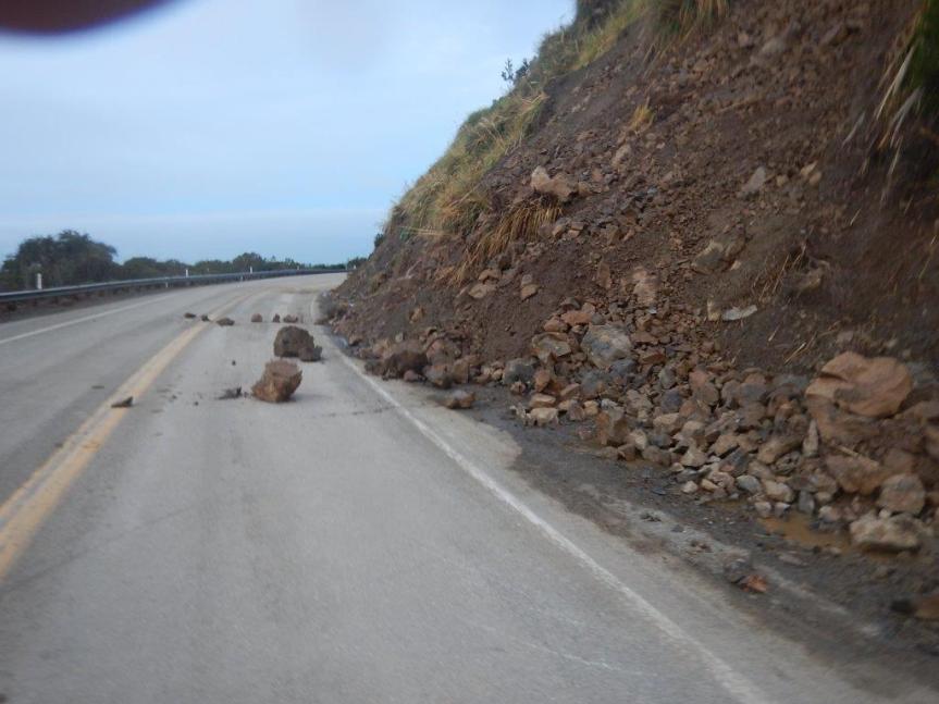
Top to Bottom: 1 and 2) just south of Grimes Canyon (PM 41.86); 3) near Anderson Canyon (PM 35); 4) around Dolan Point (PM 29.7) around half a mile north of where the CHP were posted; 5) Limekiln Campground (PM 20.76); it slid twice within half an hour mid-afternoon and CT cleared it—photo courtesy of John Davies (Limekiln Campgrounds).6) Deetjen’s (PM 43.17) ; 7)South Coast Center (PM 34.10); 8) Fernwood (PM 47.03)
The inclement weather continues to give us more slides at multiple locations, the newest and largest came overnight at Cow Cliffs (PM 28.35), but additional small slides between Cow Cliffs and now Deetjen’s (PM 43.17) require closure to extend to Nepenthe (PM 44) until further notice.
***NEW INFORMATION***
State Route 1 is now closed between Ragged Pt. (SLO 72.87) and Nepenthe (Mon 44). Another storm is expected tomorrow afternoon, Thursday, Feb. 9.
I Motorists may travel north on State Route 1 from Cambria to Ragged Point (SLO PM 72.87) or south from Carmel to Nepenthe’s (PM 44)
The roadway is not passable between Ragged Pt (SLO 72.87)and Nepenthe (PM 44)
*LOCALS MAY TRAVEL NORTH, CAREFULLY, FROM RAGGED PT. TO LIMEKILN AS THERE ARE 13 LOCATIONS WITH ONLY ONE LANE OPEN DUE TO ROCK/MUDSLIDES.
Thank you for your patience and understanding. Our Maintenance, Geotech and Construction crews continue to work collaboratively and diligently, as much as safely possible in response to these rock/mudslides.
Another update will be provided on around mid-morning tomorrow, Thursday, Feb. 9, or sooner if conditions change.
Susana Z. Cruz nature-flower-blue-motif[1]
Caltrans District 5
Acting Manager
Public Information Office
Gerente Interino
Oficina de Relaciones Públicas
para Caltrans en el Distrito 5
805.549.3138
805.549.3326–fax
Follow us on Facebook
We welcome your feedback: https://www.surveymonkey.com/r/RNBZG55


Photos from this weekend of: 1) Temporary Mesh Netting installed at Big Creek/Cow Cliffs (Sat-PM 28.5); 2) Rock fall at Lucia (Sun-PM 23); Rock fall at Paul’s (Sun-PM 26.10); and Partington Ridge (this am—PM 38.6)
***NEW INFORMATION***
The weekend’s inclement weather gave us various small slides at multiple locations, but thankfully and diligently, we have been able get the roadway clear and provide good news for tomorrow morning, weather permitting.
EFFECTIVE TOMORROW MORNING, TUESDAY, FEB. 7 AT 7 AM (WEATHER PERMITTING):
*DUE TO MORE SLIDE MATERIAL AT PAUL’S SLIDE (PM 21.6), All Motorists may travel north on Hwy. 1 from Cambria to Limekiln Creek Bridge (PM 21.3) or south on Hwy. 1 from Carmel to Lucia (PM 23).
*If you have been following our updates, you know we have dealt with various challenges, below is the status:
1) Mud Creek (PM 8.8)—continues with drilling taking place and daytime one-way traffic control (flagging). However, slide material continues to come down. Expect 20-30 minute delays.
2) The culvert has been replaced/repaired at PM 14.4 and is no longer covered with steel plates just north of Sand Dollar Beach (PM 13.85).
3) At Paul’s Slide (PM 21.6), although we have a temporary stop sign and eventually a traffic signal—MORE MATERIAL IS COMING DOWN AND THERE IS STILL A FULL CLOSURE AT PAUL’S. (see photo).
4) There was a small slide at Lucia (PM 23) this weekend, but has been cleared. (see photo)
5) Temporary mesh netting took place this Saturday at Big Creek/Cow Cliffs (PM 28.35), allowing the roadway to open at this location. (see photo)
6) There was a slide this morning at Partington Ridge (PM 38.6), necessitating the roadway to close at Fuller’s but has been cleared and will be open to traffic. (see photo).
The roadway is not passable between PAUL’S SLIDE (PM 21.6) and LUCIA (PM 23).
Thank you for your patience and understanding. Our Maintenance, Geotech and Construction crews continue to work collaboratively and diligently, as much as safely possible in response to these rock/mudslides.
Another update will be provided on around tomorrow, Tuesday, Feb. 7 afternoon, or sooner if conditions change.
Susana Z. Cruz nature-flower-blue-motif[1]
Caltrans District 5
Acting Manager
Public Information Office
10:59 AM 9 [20] 27-D5 SB LANE JSO LUCIA LODGE IS SINKING CALTRANS PUTTING OUT CONES / WILL DIRECT TRAFF TO NB LANES
Per CHP this am –
7:32 AM [18] 27-D5 CALTRANS ADVISED TO OPEN RD TEMP FOR LOCALS IN 30 MINS BUT WILL NEED TO SHUT IT DOWN IN AN HOUR TO CLEAN UP SLIDE JNO MM 26
6:59 AM 7 [16] 27-D5 CALTRANS 1097
6:15 AM 6 [12] ALSO NB LANE NEEDS TO BE CLRD JNO MM 23 (ED NOTE: MM23 IS LUCIA)
6:12 AM 5 [11] 27-D5 / REQ CALTRANS FOR SLIDE 1125 ENTIRE RD JNO MM 26 (ED NOTE: MM26 IS GAMBOA POINT)
Also, on Highway 152 At Poleline, is closed until approximately 2/10/17 due to mudslide pushing K rail into road on the Santa Cruz County side.
The rain is giving us a break today, so maybe Cal Trans can get some work done. Remember, for today and tomorrow, Highway One is closed at night from Ragged Point to Dolan Point, and during the day from Limekiln Bridge to Dolan Point due to new movement at Paul’s Slide late yesterday afternoon. This means, Highway One is NOT a through road this weekend, AND coming over Nacimiento will NOT get you through to the north. If anyting changes I will let you know. Otherwise, have a quiet peaceful day before the next round, tomorrow afternoon,


***NEW INFORMATION***
DURING DAYTIME HOURS SATURDAY AND SUNDAY ONLY:
*DUE TO MORE SLIDE MATERIAL AT PAUL’S SLIDE (PM 21.6), All Motorists may travel north on Hwy. 1 from Cambria to Limekiln Creek Bridge (PM 21.3) or south on Hwy. 1 from Carmel to Dolan Pt. (PM 29.70).
*We have multiple areas with challenges, the biggest being at:
1) Mud Creek (PM 8.8)—drilling taking place with daytime one-way traffic control (flagging).
2) We have a failed culvert at PM 14.4 but it is now temporarily passable, covered with steel plates, just north of Sand Dollar Beach (PM 13.85).
3) At Paul’s Slide (PM 21.6), although we have a temporary stop sign—MORE MATERIAL IS COMING DOWN AND THERE IS A FULL CLOSURE AT PAUL’S.
4) At Big Creek/Cow Cliffs (28.09/28.35) we have a hard closure due to damaged rock netting and exposed rock fall.
*Locals may travel north today on Hwy. 1 from Cambria to just south of PAUL’S SLIDE (PM 21.6)*
The roadway is not passable between PAUL’S SLIDE (PM 21.6) and Dolan Pt. (PM 29.70).
OVERNIGHT CLOSURES: Hwy. 1 will remain closed overnight from Ragged Point (SLO 72.87) to Dolan Pt. (MON. 29.


TWO PHOTOS OF PAUL’S SLIDE (PM 21.6), AND TWO OF MUD CREEK (PM 8.8) RESPECTIVELY, FROM YESTERDAY.
***NEW INFORMATION***
DURING DAYTIME HOURS ONLY:
*All Motorists may travel north on Hwy. 1 from Cambria to Limekiln Creek Bridge (PM 21.3) or south on Hwy. 1 from Carmel to Dolan Pt. (PM 29.70).
11:30 AM – CORRECTION TO ABOVE:
* Due to the temporary stop sign at Paul’s Slide (PM 21.6)…
All Motorists may travel north on Hwy. 1 from Cambria to LUCIA (PM 23) or south on Hwy. 1 from Carmel to Dolan Pt. (PM 29.70).
*We have multiple areas with challenges, the biggest being at:
1) Mud Creek (PM 8.8)—drilling taking place with daytime one-way traffic control (flagging).
2) We have a failed culvert at PM 14.4 but it is now temporarily passable, covered with steel plates, just north of Sand Dollar Beach (PM 13.85).
3) At Paul’s Slide (PM 21.6), we now have a temporary stop sign and one lane accessible to locals only.
4) At Big Creek/Cow Cliffs (28.09/28.35) we have a hard closure due to damaged rock netting and exposed rock fall.
*Locals may travel north today on Hwy. 1 from Cambria to just south of Big Creek Bridge (PM 28)*
The roadway is not passable between Big Creek (PM 28.09) and Dolan Pt. (PM 29.70).
OVERNIGHT CLOSURES: Hwy. 1 will remain closed overnight from Ragged Point (SLO 72.87) to Dolan Pt. (MON. 29.70) .
Thank you for your patience and understanding. Our Maintenance, Geotech and Construction crews continue to work collaboratively and diligently, as much as safely possible in response to these rock/mudslides.
Another update will be provided on Monday morning, Feb. 6, or sooner if conditions change.
7:30 am – it was quiet last night, then Just before 3 am, the cats & dogs started pounding on the roof. The South Coast 24 hour rain amounts are 2.84″ at Chalk Peak, 3.15″ at Three Peaks, and 2.74″ at Mining Ridge. That’s a lot of rain for 24 hours on saturated ground. We will be seeing movement from this. The CHP website log hasn’t been updated since yesterday at 9:46 am, so will have to wait to see what CHP, CT, or locals have to say, but it can’t be good out there with this much rain.
From Meterologist John Lindsey: “Another but stronger low-pressure system will bring
increasing clouds and rain showers Sunday evening and night. As the associated a cold front approaches the Central Coast, the southerly winds will increase to moderate gale-force to fresh gale-force (32 to 46 mph) levels on Monday. This system is forecast to tap into a large plume of subtropical moisture. Consequently, 2 and 3 inches of rain may fall on Monday with higher amounts in the coastal mountains.” BTW, Rocky Butte got over 4″ in the last 24 hours. (Up in the mountains behind and north of Hearst Castle)
These first one at of the back side and top of Mud Creek. He helped me mark them up this morning so my readers can tell what they are seeing. Doesn’t look like much to the uninitiated, and I admit, some of it I couldn’t see until he pointed it out. Look closely.


Roadside pics below were taken at the line behind the ridge and are posted below in a slide show. The arrow below that shows the direction of movement. The ? Is where Ralph thinks what Cal Trans is identifying as a “new spring” is coming from, but he can’t be certain without hiking it, which his knees no longer allow. In any event, it is probably not a “new” Spring but an “old” spring that has reactivated.
The slide show below is of photos Rock Knocker took yesterday. These markings are my own, after he and I looked at the photos together. I am not an expert. I may not have identified them all, and some of them may not be identified correctly, but I just based my markings on what I could see and what Rock Knocker has pointed out to me over the last 25 years of road watching. I hope this gives you some idea of what is going on.
This next slide show does not need markings for you to recognize what you are seeing: