

Took the day off and used the noon opening to go through Paul’s Slide and head to Nepenthe with a friend. What a lovely day. Lots of people there for lunch, but then it started thinning out. We had to stay until 5:30 for the 6 pm opening at Paul’s Slide. That was tough (joking). I got to see people I haven’t seen since before the fire!! Son came up and joined us, too, as well as a southsider friend. What a delight … and no internet all day! I had forgotten what that was like!!! And nothing important happened close to home, anyway. The Whittier Fire near Lake Cachuma and the Garza Fire in Fresno were both active. Garza made its way into Monterey County today, and there were new evacuation orders for Whittier. Back to regular programming tomorrow.
Author: bigsurkate
Appointed appellate counsel for indigent defendants (retired.) I have lived in Big Sur since 1984, first on the north coast, and on the South Coast since 1989.
Highway One closure update, 7/14/17
*NO MAJOR CONVOYS SCHEDULED FOR NEXT WEEK (JULY 17-20)*
HIGHWAY 1 UPDATE – THURSDAY, JULY 13:
State Route 1 in Monterey County continues to be closed from north of Salmon (just south of the Ranger Station (PM 3) to Pfeiffer Canyon (PM 45.5), which is south of the Pfeiffer Canyon Bridge construction site, with the exception of 10 miles (Gorda to Limekiln State Park) that is accessible only via Nacimiento-Fergusson Road.
REMINDER: travelers CANNOT go all the way on Hwy 1 but local businesses are open on both sides of the closure points at Pfeiffer Canyon and Salmon Creek.
Mud Creek (PM 8.9)
Mud Creek had a major slide on Saturday, May 20, 2017, losing 5 million cubic yards of material. Geotechnical and radar assessments continue at the site it remains impassable.
Paul’s Slide (PM 21.6)
The targeted opening for the road at Paul’s Slide is mid-July (July 15-20). Until then, access through Paul’s Slide continues with the following schedule for local residents and deliveries:
Access times for the morning and evening
Sat-Thursday: 5:30 am to 6 am and 7 pm to 7:30 pm
Friday: 5:30 am –8 am and 6 pm to 7:30 pm
12:00 noon Monday/Wednesday/Friday
A single caravan south and a single caravan north will be allowed. You must be in line by noon! There may be up to a 45-minute delay to clear the road before the opening.
Delivery vehicles (restricted to 30 feet maximum length and 50,000 lbs. maximum weight) can use all access windows shown above.
Pfeiffer Canyon Bridge [PCB] (PM 45.52)
· Steel girders continue to be fabricated in Vallejo, CA and are being sent to Linden, CA (near Stockton) for painting before being trucked to the Pfeiffer Canyon Bridge construction site.
· Temporary Tower completion and welding
Nacimiento Rd. 1 lane Blocked
9 am – there is a tree down on Nacimiento. While the CHP website says SR1 and Nacimiento, that is just the nearest cross street. So it could be anywhere. MoCo Rds come from San Ardo, so it could be a while.
Incident: 00093 Type: Traffic Hazard Location: Nacimiento Fergusson Rd / Sr1 Loc Desc: Lat/Lon: 35.988672 -121.494108
Detail Information
9:15 AM 2 [5] PER A8-040 START CORDS / 1039 MONTY CORDS
9:00 AM 1 [2] TREE DOWN / 1125 1 LN
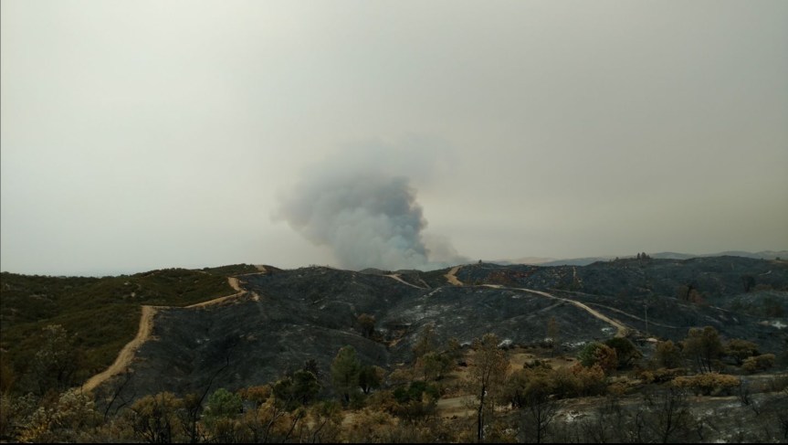
Wildfire – Lucia
8:30 pm – it looks as if the heavy, immediate use of aircraft was successful, as I am hearing the smoke is gone and things seem to have quieted down out there.
6:40 pm – IC believes, if aircraft can pummel it from the air, they should be able to hold it. They have 5 planes on it right now.
6:20 pm –

6: 15 pm-Arroyo Seco Gorge making it up to the ridgeline. This is a very remote area, which has a very long access time. Aircraft will be it for a while. Lucia IC requested a dozer to come in and open up a road for responding in units. LPF, BEU, and FHL responding.
LPF Engine 19 advising they cannot see entire fire, but it is running to the ridgeline. Requesting air resources to give better size up. And dozer to open up roads for access. This has potential to be a large fire, unless they can stop it from the air.
From WildCAD:
Recent Incidents (Prepared 07/12/2017 18:17)
Date Inc # Name Type Location WebComment Resources IC Fuels Acres Lat/Lon
07/12/2017 17:27 LPF-1825
LUCIA Wildfire SANTA LUCIA CR M . DIV1LPF E15LPF 4X4 E16LPF 4X4 E18LPF E319LPF E52SNF PAT17LPF Q PAT34LPF HUGHES Effective 7/12/17 @1750 HRS . . 36.177 x 121.464
State Wildfire Map, 7/12/17

Numerous Fires along the 101 in Paso
4:15 pm – apparently, these fires were small veg fires along 101 from Atascadero up to Paso so far…..I’ll bet some ones dragging a chain….we’ve got units from Atascadero, templeton, an Paso running 101 putting them out. Currently, all but one is small and mostly in the center lane. One is at Exline, which is very north end, where the PR RV Parks is. I’ve stayed there many times. This one bears watching. This is a mess. Read the CHP report below. Glad I am not in Paso today…
4: pm – I took the day to run to King City, so just catching up, here. Looks like someone drug a chain, and sparked a bunch of fires. Let me catch up and I’ll update, but in the mean time, here is the chp dispatch:
4:14 PM 38 [144] 1039 CALTRANS
4:14 PM 37 [143] 1039 9-L,MADE NOTIF TO DIV CHIEV//REQ ADV ENTAC IF UNITS ARENT ABLE TO OPEN A LN
4:12 PM 36 [140] [Notification] [CHP]-PRPD REQ CLOSE NB 46W ONR AND CLOSE THE NB RAMADA TURN LN TO WB 46W//PRPD HAS CITY STREET CREWS ENRT TO ASSIST [Shared]
4:08 PM 35 [134] 1039 CALTRANS // ALRDY HAS 2 SUPV ENRT TO AREA
4:06 PM 34 [132] B9-008B NB N SPRING OFR IS CLOSED // PASO PD HAS NB ONR CLOSED
4:06 PM 33 [131] 1039 9-L,REQ ADV ENTACT IF CLSOURE IS LONGER THAN 90 MINS
4:05 PM 32 [129] B9-001B 101 AT SR46W // DIVERTING TRFC OFF AT SR46W // TRAFFIC IS GRIDLOCKED
4:03 PM 31 [128] [CHP] has closed their incident [170711SL00170]
4:01 PM 30 [125] 1039 9-L
4:00 PM 29 [124] [Notification] [CHP]-RP ADVS 15-20 VEHS BEING 23103 NB 101 AT MAIN FLIPPING AROUND , NEAR TCS DUE TO FIRE IN THE AREA AND FRWY CLOSURE [Shared]
3:57 PM 28 [121] [Appended, 15:57:30] [1] RP ADV AT A CARE FACILITY NR THE FIRE JNO N SPRING,CONC ABOUT NEEDED TO EVAC PATIENTS
3:56 PM 27 [118] B9-008 ADDTL FIRE NB ON NB SPRING OFR AREA WILL 1023 TO ASSIST
3:39 PM 26 [117] [Notification] [CHP]-CAL FIRE L/L REQ UNIT SHUT DOWN SPRING ST OFR [Shared]
3:36 PM 25 [116] B9-004B NB 101 CLOSED AT SPRING
3:30 PM 24 [104] [Appended, 15:31:54] [1] RP ADVSD BRUSH FIRE NEAT STOCKDALE AND EXLINE
3:22 PM 23 [69] B9-001B VINEYARD OFR IS RE OPENED
3:21 PM 22 [67] [Notification] [CHP]-PER ATAS IF WE HAVE ANY UNITS RESPONDING TO THE FIRE IN THE CITY THEY CAN 1022 [Shared]
3:21 PM 21 [100] [Appended, 15:26:46] [22] [Notification] [CHP]-CAL FIRE ADVSD NOW STATING ADDITIONAL FIRES PASSING MONTEREY
3:19 PM 20 [46] B9-004B HAS S SPRING OFR CLOSED
3:18 PM 19 [45] FIRE ALSO RPTD SR46W // N SPRING // S SPRING // SR46E // MONTEREY
3:17 PM 18 [49] [Appended, 15:19:24] [2] BRUSH FIRE
3:16 PM 17 [52] [Appended, 15:19:29] [1] ADDTL CALLER ADVD FIRE STARTING AT SR46E
3:15 PM 16 [61] [Appended, 15:19:35] [9] [Appended, 15:15:55] [2] TOT CAL FIRE
3:15 PM 15 [60] [Appended, 15:19:35] [8] [Appended, 15:15:55] [1] FIRE BTWN N SPRING AND WELLSONA
3:14 PM 14 [57] [Appended, 15:19:35] [3] ANOTHER FIRE ON MONTEREY
3:13 PM 13 [55] [Appended, 15:19:35] [1] BRUSH FIRE
3:13 PM 12 [96] [Appended, 15:26:46] [29] [Appended, 15:24:18] [7] [Notification] [CHP]-PER CAL FIRE – RESP TRK FOR STARTING FIRES MAR FBED SEMI TRK JUST TOOK EB 46E FRM 101 OK 28 CHXM37
3:13 PM 11 [95] [Appended, 15:26:46] [28] [Appended, 15:24:18] [6] ADDTL FIRE AT 46W – CAL FIRE COPS
3:11 PM 10 [84] [Appended, 15:26:46] [13] B9-001B NB VINEYARD OFR IS CLOSED
3:10 PM 9 [42] [Notification] [CHP]-PER CALFIRE,BELIVES FIRES POSS STARTED BY VEH DRAGGING A CHAIN,REQ UNIT BOL [Shared]
3:08 PM 8 [72] [Appended, 15:26:46] [3] B9-001B VISUAL OF A FIRE AT VINEYARD
3:07 PM 7 [70] [Appended, 15:26:46] [1] FIRE STARTING ON THE LAS TABLAS ONR
3:06 PM 6 [40] [Appended, 15:09:31] [2] FIRE DEPT IN THE AREA
3:05 PM 5 [24] [Appended, 15:05:26] [1] CITZ STOPPED TRYING TO PUT OO FIRE
3:02 PM 4 [7] [Appended, 15:02:49] [1] FIRE STARTING ALONG RS
3:02 PM 3 [3] TOT APD FOR FIRE
3:02 PM 2 [4] [Appended, 15:02:22] [1] BRUSH FIRE ON RHS
3:01 PM 1 [1] BRUSH FIRE
Unit Information
3:19 PM 12 Unit Assigned
3:19 PM 11 Unit Enroute
3:19 PM 10 Unit At Scene
3:56 PM 9 Unit Assigned
3:56 PM 8 Unit Enroute
3:56 PM 7 Unit At Scene
3:56 PM 6 Unit Assigned
3:56 PM 5 Unit Enroute
4:06 PM 4 Unit Assigned
4:06 PM 3 Unit Enroute
4:10 PM 2 Unit Assigned
4:10 PM 1 Unit Enroute
Highway One Closure Update, 7/10/17
MONDAY, JULY 10-HIGHWAY 1 CLOSURE UPDATE: FROM JUST NORTH OF SALMON CREEK (MON 3.0) TO THE “MAF” (PM 46.35)- PAUL’S SLIDE CONTINUES WITH LOCAL/DELIVERY ACCESS AND MUD CREEK REMAINS CLOSED INDEFINITELY–NEXT UPDATE THURSDAY, JULY 13.
No changes since last update, Friday, but here are a couple photos of the progress on the Pfeiffer Canyon Bridge:


Fire Updates, 7/10/17

BTW, FRA is federal responsibility area and SRA is state area responsibility.
8:00 am –
Whittier – 10,823 acres and 10% containment (Lake Cachuma)
Alamo – 29,000 acres and 15% containment (E. of Santa Maria)
Stone -340 acres and 40% containment (Santa Margarita)
Parkfield -1816 acres and 80% containment (San Miguel) Unless there is a significant development, this will be the last report on this fire.
Garza – 5000 acres and 5% containment (Fresno/SLO/MoCo border)
New Fire in SLO Co – Stone Fire
5:00 pm – people and 2 of 3 horses okay. 1 horse MIA

4:30 pm – here is a google map of where the Stone Fire started:

4 pm – FYI – there is yet ANOTHER fire near the SLO/Monterey/Fresno line out on Jack Ranch near Chalone, but won’t be creating a new thread while Stone is threatening lives. Jack Ranch (the Garza Fire near the border of MoCo/SLO Co/Fresno) I will come back to – maybe.
3:30 pm – from SLO OES: Evacuation Order for #StoneFire. HWY 58 from Huer Heuro north to O’Donovan & Shooting Star. Including Blue Rd, Blue Ridge, Isabel Rose Ln
3:00 pm – IC is asking for anything that’s available. “Structures are occupied, burning, and threatened”. 2-300 acres 7 Tankers en-route, No divert – Life threat for occupied structures
Photo by Nicklaus Johnson. Can see where the other fire burned just a week or two ago in Santa Margarita…
2:30 pm – A new fire out near Huer Huero Rd near Creston just started and is up to 100 acres with RROS. Some structures involved and other strictures threatened. “All tankers diverted from the Whittier Incident to the Stone for immediate life threat to civilians.”
Not good at all…
Fire Updates, 7/9/17
9 pm update:
Alamo: Update : 23,876 acres – 15% contained
Whittier: as of 11 this am – The fire is 7,800 acres
Parkfield: Update : 1,816 acres – 60% contained. Forward spread stopped.
Stone: Update, 340ac, forward progress stopped. Structures lost.
Garza: Update 2000 acres
7:00 am updates:
Parkfield: as of around midnight last night, this one is 1500 acres and 30% contained.
Alamo: as of 6 am this one is up to 23,867 with 10% containment and heading west and south toward the 101 and Santa Maria. Here is a fire map:

Whittier Fire: is 7800 acres and has crested Santa Ynez mountain and visible from Goleta now. This was 11 pm last night and from Goleta:
