Pfeiffer Fire, Day Two – a local’s perspective

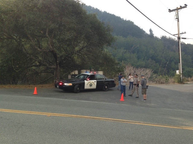
5:00 pm – went to the meeting. Basic facts are 769 acres, 20% contained, full containment expected by Friday. 24 structures lost. We are expecting winds starting tomorrow night, but hopefully it won’t create any problems. Saw Celia at the meeting, and CPOA quietly gave checks to those confirmed to have lost houses.

Noon. I have been up here in Big Sur proper for 3 hours now. I’ve talked to locals, including Celia Morganrath Sandborn, her mother Helen Morganrath, and others. I heard her story of the harrowing escape she led her family and neighbors on, just because a small bladder woke her up. I will resell it with her permission later. I also have taken photos, some of which I will upload on the photos post, yet to be created. I also have some updates for official announcements, but having a bite to eat.

20131217-055839.jpg

5:30 am – I will be posting throughout the day any relevant, helpful, information. Will start with this photo sent to me just after midnight this morning of firefighters defending the Halvorsen’s house, taken by Jeff Mallory.

My blog was inundated yesterday, and many people who had never commented before, which requires moderation, were commenting. That slows down the process tremendously. I also noted some speculation and inaccuracies, against which I would strongly caution. Specific offers to help are greatly appreciated, but they are hard to locate on my blog. A better venue for that is big sur cert which is organized specifically for offers of help so that those seeking it can find what they need.

It will be another long and stressful day for all those involved. Lets make it as easy on ourselves as we can. Strive for accuracy first and foremost. Be gentle with one another. I will, in all probability have three separate posts going and being updated throughout the day. This one, a local’s perspective; one, official announcements; and thirdly, a photos page. That way we can easily keep track.

Pfeiffer Fire Photos

20131216-215808.jpg

The above photo is also by Jeff Mallory. The photo credits on the ones below are FUBAR. Nighttime ones are by Jeff Mallory, daytime, by Howard Jones, except the top four by Stan, and the one by Jeff of the helicopter and Cal Fire truck. And then there is the one of MK’s house, if I ever get it up! Sorry, it has been crazy today!

These four photos are by Stan Russel, Big Sur Chamber of Commerce.

20131216-174355.jpg20131216-174323.jpg20131216-174216.jpg20131216-174158.jpg

This photo is by Jeff Mallory taken by his front gate.
20131216-170838.jpg

The following are by Howard Jones.
20131216-170920.jpg20131216-170938.jpg
The following are from Jeff Mallory from early this am.
20131216-171039.jpg20131216-171123.jpg20131216-171206.jpg20131216-171451.jpg

20131216-182151.jpg

Ponderosa Fire, 8/2/09

8:30 pm – reports are that Ponderosa has reached 500 acres. Sam Jones is 600 and moving north across containment lines. Here is a last look at the Ponderosa fire tonight. This photo is not as spectacular as the plumes from earlier, but what it shows is fire in an east west Canyon, moving in both directions. This canyon is north of the McKern Rd. firebreak, which I drove on today. It is wide, and it is clear, so it would be hard for the fire to cross that. And if this canyon fire does move west, as it appears, it will run into the footprint of the Chalk Fire.

DSC_0268

You can see the smoke all the way down the canyon, behind the trees and the bushes. It actually goes even further west, but that is not visible in the photograph. This is shot looking north north-east, so west would be off the left side.

News release just came in at 2:56 pm. See USFS page to the right for the entire missive.

2:00 pm update:Jim Smith’s Type II Incident team will be in command. You can find information about the team here: http://ccimt7.imtcenter.net/main/index.aspx

Spoke with District Ranger Tune and the press release is being prepared. At this point they are calling it 200 plus. She said when the team comes in at 1700 (Smith’s Type II IT) then it is her understanding that the Ponderosa will be put up on inciweb. I would imagine that might not happen until tomorrow morning.

WildlandFire posted this: “Per Southops: Ponderosa CA-LPF-2563, The fire has burned 250 acres with a potential to triple in size. Ponderosa and Nacimiento Campgrounds have been evacuated. The Nacimiento-Ferguson Road has been closed. Smith’s Type II Incident Management Team has been assigned to the fire.”

More photos from late this morning to follow here:

DSC_0232

This was was taken at 11:04 am, and clearly shows the McKern Rd. firebreak.

DSC_0235

These people snuck through before the signs were posted on Highway One, but were turned around. This is the intersection of South Coast Ridge Rd. and Nacimiento.

DSC_0238

This photograph shows the burn from the Chalk Fire, with the Madrone regrowth and the Ponderosa Fire in the background.
DSC_0240

You tired of these plumes, yet? I have a couple more showing the progression of the north flank, then I am finished until this evening, when I will go shoot some more photos.
DSC_0241

Here’s the last one this afternoon, showing the progression of the north flank.

DSC_0248

When I know more, I will post more.

1:30 pm. These photos were taken starting at 10:50 am from various places along South Coast Ridge Rd. This first one is from 10:50 am from about 1/2 mile south of Plaskett intersection.

DSC_0220

I took a series of shots in 2 minutes from this spot, and it is interesting to watch the progression. I’ll post 4 here.

DSC_0222

DSC_0224

DSC_0225

And now, a short break in the photo show, so that I might bring some information to my readers in the 2:00 pm update above.

12:30 pm. Just got back from my field trip. Photos and more photos up shortly. Impressive plumes. Fire south of N-F Rd., and north of the McKern Rd/firebreak. Lots of air attack. 3-4 miles, maybe 5, from me. Spotters up on South Coast Ridge Rd just north of McKern. N-F Rd. closed. Sheriff on top. Locals can go west. Now, to sort and post some photos.