Dramatic Photos at Highway One and Pfeiffer

Just taken at 11 am, I am just uploading without editing, and will post immediately, and then add more photos. I am hanging out at the Roadhouse where they are taking such good care of everyone, including me. I am probably not going to town today. I filled up at Fernwood, and will go home when I am done up here today. I need to get out of the smoke, and I need some rest.

20131218-112807.jpg

20131218-112923.jpg

20131218-113940.jpg

20131218-114241.jpg

20131218-115244.jpg

20131218-120105.jpg

20131218-120534.jpg

20131218-121504.jpg

20131218-122110.jpg

20131218-122428.jpg

20131218-132249.jpg

20131218-132608.jpg

20131218-132818.jpg

20131218-133232.jpg

20131218-133536.jpg

20131218-133801.jpg

20131218-134042.jpg

20131218-134659.jpg

20131218-134953.jpg

20131218-135143.jpg

Pfeiffer Fire, Day 3 – photos

20131218-092338.jpg

20131218-091946.jpg

20131218-091833.jpg

20131218-091644.jpg

The photos above were taken this am. I apologize for the blur of the one of the fire. I couldn’t stop.

The photos below were taken last night:

20131218-090013.jpg

20131218-090831.jpg

20131218-091032.jpg

20131218-091155.jpg

20131218-091420.jpg

Pfeiffer Fire, Day 3 – a local’s perspective

8:00 pm – a locals’s perspective. I have made it home to the quiet, the wet fog, and little smoke. I have posted everything I wanted to or needed to for today … More than the three different posts I intended because I had so many photos of mine and Jeff’s I wanted to share. It is amazing how intense three days can be. I am so grateful to my community for their strength, compassion, and organization. Being a part of it is such a blessing. The LA Times did an article which shows this unusual community in our finest hours. I am very grateful that you all – Big Surians at heart, in the past or in the present – allow me to provide a service that many find valuable. It is my honor to be useful doing what I enjoy.

5:00 pm – here is what CPOA is sending out:
Hello Everyone,

Progress is being made on the fire and CPOA is aggressively moving forward in setting up the necessary steps that will be needed in the aftermath of this fire. Following is one of the first of those steps, site assessment.

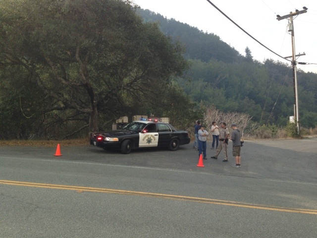
Tentatively tomorrow, Thursday December 19th, if it is safe to do so, Monterey County officials from Planning, Building and Environmental Health will be conducting site assessments inside the burn area to determine if it is safe for people to re-populate. The criterion to be used to determine if it is safe revolves around :

1. Is the housing structurally safe.
2. Is the water system working and is it safe to drink.
3. Is the sanitary system (septic) operational.

Each situation will be assessed a color coded grade with Red being not inhabitable, Yellow safe to enter but not cleared for habitation and Green, safe for habitation.

As was the case during the Basin Fire in 2008, the County will not be looking at code enforcement issues of any kind nor concerning itself with whether or not a particular structure was permitted.

As part of the assessment process that will take place, Environmental Health will be taking ash samples for analysis to determine if the fire debris can be accepted at the Marina Landfill and treated as simple household waste. This was a protocol that was followed during the Basin Complex Fire.

On to the fire, the weather conditions have changed significantly since yesterday. There is a mid to upper level storm coming in that will hopefully bring precipitation to the area and help put a damper on the fire. Following is some general information about the fire and its progress.

As of this writing (11 AM Wednesday morning 12-18-13) the Pfeiffer Ridge Fire is active and generally within a geographic boundary that is bounded by Highway 1 to the East, Sycamore Canyon to the South, Bear Killed 2 Calves Creek (Middle Ridge) to the West and the Clear Ridge Road from Brewers Bridge to the intersection of Middle Ridge.

The fire has burned nicely down to the Highway,leaving all the big Oaks and Redwoods but cleaning up the understory,posing no risk for spreading further East. Inside that perimeter however, the fire continues to make runs up and down the various steep drainages and hog back ridges. Back firing is also underway in Sycamore Canyon and from Highway 1 back up the Pfeiffer Ridge Road.

The humidity has gone way up and the temperature, as forecast is in the low 50’s with wind generally non existent except that which is created by the fire. There is even a slight chance of rain later today. However, all of that is predicted to change over night and through Friday, when this cold front passes and a strong Northwesterly wind is progg’ed to kick in over the still active fire.

Be advised, this wind condition could significantly raise the chances for the spread of live embers in the direction of Rancho Rico, Post Ranch, Coastlands, Nepenthe and areas South and East of those locations.

The best way we can prepare for this is to make sure your gutters and roofs are clear of flammable debris and if possible, be on your property or have people on your property to monitor and extinguish small spot fires, if they occur.

Folks, there is every possibility that this wind event could fizzle out, the fire could lay down, it could miraculously rain or …… However, it does not hurt to be pro-active and exercise an abundance of caution by a heightened sense of awareness of a changing and fluid situation.
*****************************
1:00 pm – well, there goes the living room, locals feel of The Roadhouse. The Associated Press out of SF just showed up, and locals have fallen quiet.

7:00 am – (Kate) Stayed with a friend in the State Park last night. Went outside late, and immediately called her out, as I could see a wall of glowing fire bearing down from across Highway One. We knew we were okay, as the ICC was between us and the fire. But it was quite the site. it is amazing how beautiful something so destructive can be! Hundreds of CDCR ff inmates were between us and the fire.

20131218-072105.jpg (From yesterday) so we knew we were fine, but very eerie.

I, personally, and the blog itself, have been absolutely inundated. Over 18,000 visitors Monday, and over 15,000 Tuesday. Debbie has been personally overwhelmed by the fire and the loss for so many friends and may have dumped your comment before it got posted. If so, we apologize. We will continue to do our best today. My morning will be spent getting more photos and stories, then running up to town for supplies, then back home by this evening. I will post what I know or see when I can. Keep the faith, prayers and thoughts coming.

Pfeiffer Fire, Day 2 – official announcements

Basics from the meeting: 769 acres burned, 24 structures lost, 20% contained. full containment expected by Friday.

Please share with all that the county’s crisis counseling team is available to those who are experiencing stress and need assistance to handle this crisis. This service is available to both citizens and first responders. The counseling contact line is 831-755-4111.

Maia Carroll

2:00 pm –
ICP Advises Evacuation Watch is being issued for residents West of Hwy 1 between Fernwood and River Inn. Notices are being delivered in person by LE. This is advisory only.
***************************************
Community Meeting sponsored by BSVFB this afternoon at 4:00 at MAF. I plan on attending.
**************************************

Pfeiffer Fire
Los Padres National Forest December 17, 2013 8:00 AM
UPDATE
Fire Information Phone: (831) 667-0951

Incident: Pfeiffer Fire, started on December 16, 2013
Location: Pfeiffer Ridge Area, Big Sur, CA
Agency Jurisdiction: USDA Forest Service.
Cooperating Agencies: Big Sur Volunteer Fire Brigade, CalFire, Monterey County Sheriff
Current Size: 550 Acres Cause: Under Investigation
Containment: 5% Structures Threatened: Residences-200 Commercial Property-20 Outbuildings/Other-20

Current Resources: Crews: 18 Engines: 44 Helicopters & Airtankers: Are Available Dozers: 8
Total Personnel: 495

Last Night’s Observed Fire Activities: Fire continues to be active at night in the Pfeiffer Ridge community and on the south flanks backing down towards Sycamore Road.

Current Situation: Today crews continue to be challenged by the steep and inaccessible terrain, narrow roads and erratic fire behavior. Firefighter and public safety are the highest priorities.

Crews will continue to attack the fire directly, build containment lines around the perimeter of the fire, improve on lines built yesterday and provide structure protection.

Central Coast Team 7, Incident Commander Nunez, assumed command of the Pfeiffer Fire this morning at 6:00 am.

Evacuations: Pfeiffer Ridge Community from Sycamore Road on the south to Clear Ridge on the north, to Highway 1 on the east and the Pacific Ocean on the west.

Multiple structures were consumed or damaged during the first few hours of Pfeiffer Fire, however the extent of the damage is unknown until an accurate assessment is made.

Road Closures: Sycamore Road, Pfeiffer Ridge Road, Clear Ridge Road, and the road from River Inn to intersection with Pfeiffer Ridge Road. HIGHWAY 1 remains OPEN! Situational Awareness while driving is encouraged due to increase in emergency vehicles accessing the fire area. BE SAFE!

The Red Cross has established an Information Center (831-320-9989 ) for evacuees at Fernwood Resort, 47200 Highway 1, Big Sur, CA

A community meeting for the residents Big Sur is scheduled for 4:00 pm today at Big Sur Station, Highway 1, Big Sur, CA

#######################################

Red Cross Opens Client Service Center in Response to Pfeiffer Wildfire in Big Sur

CARMEL, CA (December 16, 2013) – Early this morning, the American Red Cross Monterey Bay Area Chapter volunteers began working closely with local officials to help those evacuated by Pfeiffer Wildfire in Big Sur, California. Volunteers were on the scene all day providing food, emotional support, and information to those who had to evacuate their homes.

IF YOU NEED HELP
A Red Cross Client Services Center will opened to provide affected residents with needs assessment, information, replacement medications, and other recovery resources on Tuesday, December 16 from 10 a.m. to 7 p.m. at the Fernwood Resort Big Sur, 47200 Highway 1, Big Sur. The center will be open daily for the next few days. The Evacuation Center, which opened this morning at the Grange Hall, is closing tonight.

Affected residents, who need emergency assistance outside of the regular Client Services Center hours, can call the 24-hour Red Cross Client Assistance hotline at 831-320-9989 to speak with a Red Cross caseworker.

Pfeiffer Fire, Day Two – a local’s perspective

5:00 pm – went to the meeting. Basic facts are 769 acres, 20% contained, full containment expected by Friday. 24 structures lost. We are expecting winds starting tomorrow night, but hopefully it won’t create any problems. Saw Celia at the meeting, and CPOA quietly gave checks to those confirmed to have lost houses.

Noon. I have been up here in Big Sur proper for 3 hours now. I’ve talked to locals, including Celia Morganrath Sandborn, her mother Helen Morganrath, and others. I heard her story of the harrowing escape she led her family and neighbors on, just because a small bladder woke her up. I will resell it with her permission later. I also have taken photos, some of which I will upload on the photos post, yet to be created. I also have some updates for official announcements, but having a bite to eat.

20131217-055839.jpg

5:30 am – I will be posting throughout the day any relevant, helpful, information. Will start with this photo sent to me just after midnight this morning of firefighters defending the Halvorsen’s house, taken by Jeff Mallory.

My blog was inundated yesterday, and many people who had never commented before, which requires moderation, were commenting. That slows down the process tremendously. I also noted some speculation and inaccuracies, against which I would strongly caution. Specific offers to help are greatly appreciated, but they are hard to locate on my blog. A better venue for that is big sur cert which is organized specifically for offers of help so that those seeking it can find what they need.

It will be another long and stressful day for all those involved. Lets make it as easy on ourselves as we can. Strive for accuracy first and foremost. Be gentle with one another. I will, in all probability have three separate posts going and being updated throughout the day. This one, a local’s perspective; one, official announcements; and thirdly, a photos page. That way we can easily keep track.

Comments

Dear Friends, We much appreciate your sentiments and prayers. We are trying to keep our eye on the ball here. We’ll keep you up to date. Too busy to respond to all. Just a giant thanks to you.

Deb

Evacuation Watch & IC Info from USFS

Final evening update at 9:30 pm – no update on size or containment, but we do know that there are now 625 firefighters and support personnel on the fire. We also know that despite her personal loss, our Fire Chief, Martha Karstens, is still leading our amazing BSVFB, along with the USFS and Cal Fire teams in battling this blaze. I am calling it a night and will be back with the dawn. Meanwhile, keep our community in your thoughts, and consider a donation to our BSVFB.
************************************************

Incident Information
Monterey Ranger District
Los Padres National Forest

PFIEFFER FIRE
Update
December 16, 2013
5:00 PM

The Pfeiffer Fire started after midnight on December 16th in the Pfeiffer Ridge area just west of Big Sur, CA . The size of the fire is approximately 500 acres and is 0% contained.

Crews are actively working to protect homes in the area. There has been multiple structures consumed and or damaged by the fire, but it is still too early to do an accurate assessment.

An evacuation of the Pfeiffer Ridge area is in effect. The evacuation area is from Sycamore Canyon Road on the south to Clear Ridge on the north; Highway 1 on the east and the Pacific Ocean on the west.

The Red Cross has established an evacuation center at the Big Sur Grange. NOTE:THIS WAS CHANGED THIS EVENING AROUND 8:00 PM – “Kate and Kirk, If you have not already heard from the Red Cross, I am told they are closing the evacuation center at the Grange tonight and will reopen at Fernwood Resort at 10 am Tuesday to serve evacuees. Not a shelter set up, but an evacuation center with services for folks.”

Road closures in effect are as follows:
Clear Ridge Road
Pfeiffer RidgeRoad
Sycamore Canyon Road
Road from the River Inn to Pfeiffer Ridge Road.

*** HIGHWAY 1 IS OPEN***

The fire remains active making runs, with some spotting. Early today, resources reached 200 personnel assigned with additional resources responding all day.

Central Coast Interagency Incident Command Team will be transitioning on Tuesday, December 17, 2013 at 6:00 AM. To assume management of the fire. The Incident Commander of the Type II team is Mark Nunez.

A community meeting is tentatively planned for Tuesday afternoon at the Multi Agency Facility. More information to follow.
******************************************************************************

Please share widely:

The Pfeiffer Fire Incident Command has requested an emergency notification for Big Sur residents in the Pious Ridge and Sycamore Canyon areas. This is the text of the alert that went out at 5:30pm:

This is the Monterey County Office of Emergency Services with an Evacuation Watch due to the Pfeiffer Fire.
There is a threat to life and property in the Sycamore Canyon and Pious Ridge areas. If you choose to evacuate, thre is a Red cross shelter at the Big Sur Grange.

An evacuation watch means that emergency crews recommend people evacuate for their safety. The next level would be an evacuation warning, which is more serious and means emergency crews want residents to evacuate right away.

Maia Carroll

Pfeiffer Fire Photos

20131216-215808.jpg

The above photo is also by Jeff Mallory. The photo credits on the ones below are FUBAR. Nighttime ones are by Jeff Mallory, daytime, by Howard Jones, except the top four by Stan, and the one by Jeff of the helicopter and Cal Fire truck. And then there is the one of MK’s house, if I ever get it up! Sorry, it has been crazy today!

These four photos are by Stan Russel, Big Sur Chamber of Commerce.

20131216-174355.jpg20131216-174323.jpg20131216-174216.jpg20131216-174158.jpg

This photo is by Jeff Mallory taken by his front gate.
20131216-170838.jpg

The following are by Howard Jones.
20131216-170920.jpg20131216-170938.jpg
The following are from Jeff Mallory from early this am.
20131216-171039.jpg20131216-171123.jpg20131216-171206.jpg20131216-171451.jpg

20131216-182151.jpg

Fire on Pfeiffer Ridge

4:00 pm – Hi Kate – just a couple of things from this end to share with folks –

Can we encourage folks to sign up for public safety notifications AlertMontereyCounty – this is the system that people can get emergency notifications via cell phone (like reverse 9-1-1). When the emergency notice went out overnight to folks in the fire area, we noted that only 125 people where signed up for that area, and there are likely more would want it. Here is the link

http://alertmontereycounty.org/

Also – Red Cross and SPCA want to make sure evacuees know that the shelter is up and running at the Grange, folks who evacuated can get meals, services there – pets welcome and will be housed by SPCA on site.

CalFire folks say smoke this afternoon did prevent the air tankers from dropping retardent in the most active areas of the fire but helicopters were still able to do water drops.

Maia Carroll (MoCo Communications)

For spot weather reports on the fire area, see here:

2:00 pm – (Kate) Cal Fire reports 500 acres, 15homes lost. Reader/observer reports it jumped the road on lower Pfeiffer Ridge and is heading west. Cal Fire working on strategy. Both Debbie and I are working on moderating all new comments, but some seem to be speculation about who’s house has burned, and unless confirmed, we are not approving those. Lots to keep up with. Do have photos, and will try to post what I can when I can.

8:30 am – (Kate) I am monitoring the situation, and it is not good. I am having serious Internet difficulties, but will keep trying. Comments by people who have never commented before must be approved, which I am trying to do, and there are a lot of them. Debbie is in the thick of things, so can’t help much. If you have commented before, please keep us all posted, but not at peril to yourself!

I was woken up at 3:00 to news there is a fire on Pfeiffer Ridge.  Outside my house I can smell the smoke and see a fire glow.  Tried to get ahold of Kate which will be your best resource.  Just a heads up for all.  Getting ready to head into work to see if they need our heavy equipment.  No doubt Teyve is already on it.  Prays to our neighbors.