Paul’s Slide blocked by rocks tonight, 5/26/17

This is in the very narrow one lane portion. No one will be there until Tuesday to work, due to dangerous conditions. One can see the soil nail wall covered in cement under the cone, so those of you who have driven it, know exactly where this is. Photo by Brendon Shave.

IMG_2644

IMG_2648

During daylight, photos by Brendon Shave

Here it is on the south side, photo by Cal Highway:

IMG_2647

The Slide that keeps on Giving – Mud Creek

On Tuesday, I sent this still from Brian Mack’s video taken on Sunday, marking up the fractures I saw on the north side of Mud Creek to several people, including Keith Vandevere. I meant to post it on my blog, but not sure I ever did. I did send it this am to Sterling Doughty and Brian Mack via PM on FB.

IMG_2551

So, this evening, Cal Highway posted these, tagging me.

IMG_2637IMG_2640IMG_2641IMG_2643

Look for those cones in the middle of the road up on the right to hit the beach by the end of the Memorial Day weekend, if not before. One can see the fractures and all the water in these photos. Thanks, Cal Highway.


Highway Closure Update, 5/25/17

From Cal Trans:

HIGHWAY 1 UPDATE – FRIDAY, MAY 26 AT 1 PM – PAUL’S SLIDE CONTINUES TO BE FULLY CLOSED TO EVERYONE

PAUL’S SLIDE ON STATE ROUTE 1 CONTINUES TO BE FULLY CLOSED TO EVERYONE AS OF 1 PM, THURSDAY, MAY 25. CALTRANS ENGINEERS REPORT CONTINUED SLIDE ACTIVITY AND THE AREA HAS BEEN CLOSED IN THE INTEREST OF PUBLIC SAFETY. THE RADAR MONITORING SYSTEM SHOWS SLIDE ACTIVITY HAS CONTINUED TO ACCELERATE; CALTRANS IS NOT COMFORTABLE WITH ANYONE ATTEMPTING TO PASS BELOW THE SLIDE AND MATERIAL REMAINS ON THE ROADWAY. LOCAL ACCESS AND DELIVERIES AT THE PREVIOUSLY ANNOUNCED TIMES HAVE BEEN SUSPENDED UNTIL AT LEAST NEXT TUESDAY, MAY 30, WHEN A RE-ASSESSMENT WILL TAKE PLACE AND AN UPDATE PROVIDED BY MID-DAY.

STATE ROUTE 1 REMAINS FULLY CLOSED IN BOTH DIRECTIONS AT MUD CREEK DUE TO CONTINUED SLIDE ACTIVITY. DELIVERY VEHICLES AND LOCAL RESIDENTS WILL NEED TO USE NACIMIENTO-FERGUSSON TO EXIT SOUTH OR TO CLEAR THE ACCESS TIMES AT PAUL’S SLIDE.

Aerial of Paul’s Slide:

PM 21.6 Paul's Slide Aerial 5.25.17

Aerial of Mud Creek:

PM 8.9 Mud Creek Aerial 5.25.17

Pfeiffer Bridge:

PM 45.52 PCB--Drilling of Abutment 1--5.25.17

Nacimiento’ s Unknown & Uncared for little Bridge, 5/26/17

All these photos were taken by Rock Knocker on May 25, 2017 and show the deteriorating condition of this bridge being subjected to massive stressors due to Convoys with 10 plus trucks at a time carrying loads which exceed this bridge’s capacity. This little bridge is at the very bottom of the grade on Nacimiento-Fergusson Rd., going eastbound, before one starts on the flats next to the river about 1/2 a mile from the first USFS campground – Nacimiento. This bridge is estimated to be between 50 and 75 years old, and hasn’t had ANY maintenance in a very long time. It is full of rust, deteriorating concrete and exposed rebar.

DSC_9140DSC_9135DSC_9134DSC_9133DSC_9132DSC_9124

DSC_9093DSC_9096DSC_9097DSC_9098DSC_9099DSC_9101DSC_9102DSC_9103DSC_9106DSC_9107DSC_9108DSC_9109DSC_9110DSC_9114DSC_9116DSC_9117DSC_9118DSC_9124

Deetjen’s Pop-up dinner & Southside report

IMG_2590

Here is an active link you can actually click on:

Deetjen’s tickets

**********************************************************

Dear Southside of the Bridge Residents of Big Sur,
This is an update to let you know the concerns that were raised at the Southside Community Meeting were taken to the Unified Command. That was step one, now we’re trying to make sure the right people can work with us to address some of the concerns.
Monday’s meeting was a short meeting, here are the highlights:
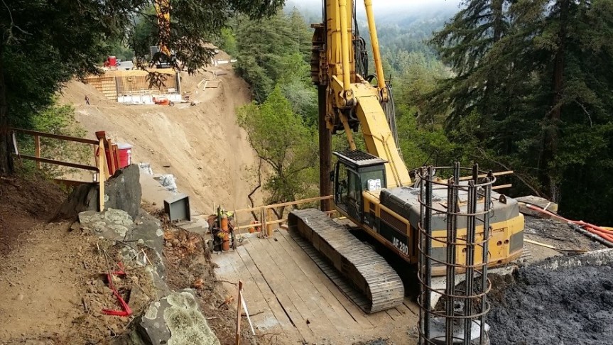
1. Cal Trans discussed Paul’s slide and explained various testing and that they are monitoring it very closely with hopes of having consistent openings by end of June. (lots happened since Monday)

2. CalTrans hopes the falling of Mud Creek is a positive step. Less material to be hauled away.
3. Convoy came across Nacemiento Tuesday and another scheduled for Thursday.
4. Sur Transportation, led by Weston: The shuttle service from Molera through the valley and to the trail is moving ahead. Plan for a soft opening of service on June 16th.
5. Lots of public education will accompany the shuttling. Trail use/best practices to be posted in parking area, on trail, in the shuttle, and within the ticket itself. Two 10 person vans will work the north and two will work the south. Still looking for drivers I believe!
6. Helicopter operator is doing his best to vary the route taken to spread the sound/sight burden
7. State Parks working on getting campground cleaned up so that they can open in July
8. USFS reports they are working through the process of closing the forest to fires early this year due to all calculations they think this can happen soon.
9. USFS working on a ban on camping along the Nacimiento road corridor as it represents the only emergency access to and from Big Sur.
10. Next Unified command meeting Monday June 5th, all are welcome.
11. Unified Command expressed an intent to hold a Southside Meeting, or send representatives to next Southside Community meeting
12. A Ride Share Website is being created, stay tuned for the link information

NEXT SOUTHSIDE COMMUNITY MEETING
POTLUCK June 7 at Loma Vista 5-7pm
Potluck and Community Update

Tell your neighbors, come and bring some yummy things to enjoy!

Carissa Chappellet


USGS Study of the Mud Creek Area, 2015-5/20/2017

I don’t pretend to understand the data presented on this link, but it was sent to me by Kenny Comello and does have some valuable photographs and insights for those who understand these things. This one screen shot causes me concern about the Sea View Ranch (see the green line dissecting right through the ranch):

IMG_2583

To see the rest of the information, go to:

USGS Mud Creek study

Later today, I will provide the most current update about Paul’s Slide from Cal Trans, once provided, and also photos of the little bridge that could (we hope) over Nacimiento.