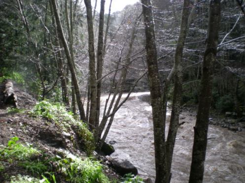
Photos for you, from my friend, Debbie Reed. Thank you once again, our north coast reporter-at-large!

Big Sur River, near The Grange, taken at 10:47 am.

Juan Higuera Creek, taken at the same time. And yes, that is a bit of sun beginning to shine through!
Received 1.75 inches last night, 2.0 inches for the storm, and 50.0 inches for the season. It is still drizzling, this morning. Looks like it will end up being a good season after all. But remember, I am at a high elevation, and get more rain than the coast usually does. For example, when I checked Nepenthe’s gauge last night, they had only received 18 inches for the season. Quite a difference! Also remember, that being on the coast side of the Santa Lucia Mountains, all my rain heads down to the coast, and Highway One!
And just as I type that, I get a message from my friend in Big Sur Valley that she got 3 inches of rain from this storm. However, she reports that everyone made it to work, from both north and south, so that indicates Highway One is passable. She also says the Big Sur River is up, but “not crazy up.” Thanks Debbie for the report!
NOAA discussion: “AS OF 9:10 AM PST WEDNESDAY…RADAR IS INDC A FEW LIGHT SHOWERS OVER THE SOUTHERN PORTIONS OF THE DISTRICT. OTHERWISE…LOOKS LIKE THIS SYSTEM IS PRETTY MUCH OVER FOR THE DISTRICT.”
At 10:00 am, I am still receiving some light sprinkles here at the southern end of the district. Friday’s system is looking to bring in quicker bursts of more intense rain, with snow at the higher elevations. (No predictions about elevation levels, yet.) Whereas, tomorrow looks to be dry, as well as most of the rest of today.

