Home Front & Station Fire Updates, 9/3/09

First, the Station Fire update. From this morning’s LA Times:
“More progress in Station fire, but canyons still under threat
September 3, 2009 | 7:04 am

The fire is now 38% contained and has burned more than 144,000 acres. It was moving southeast to the mountains high above Pasadena, Sierra Madre and Monrovia, and hand crews battled rugged terrain as they tried to protect well-known campgrounds, trails, recreation areas and the Stony Ridge Observatory. The western leg pushed toward Pacoima Canyon, prompting the evacuation of 11 homes.”

And from one of my sources: “144,753 @ 38% contain…..4,735 personnel on it, 64 homes and 49 outbuildings destroyed, helicoters have dropped 1.7 million gals. of water as this date an aircraft have dropped 670,000 gals. of retardent[.]”

One of the best collections of photos of the Station Fire I have found is from the Boston Globe, here

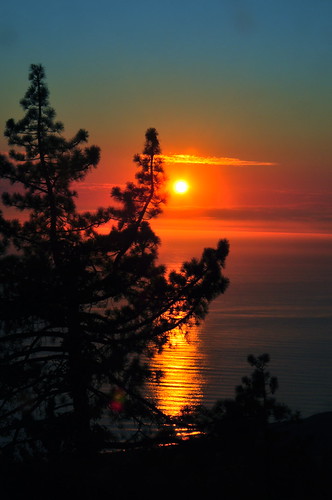
On the home front, here is last night’s sunset:
DSC_0628

And some people have asked me privately about the recovery of my dog, Dakota, from her ordeal that has been going on since the end of April. After four months of “house arrest” I finally started letting her out for 15 minutes, twice a day. All was going well, until yesterday, when she somehow pulled the injury open. I am guessing it was jumping up on the back porch. She came back early, was whimpering, wouldn’t sit down, and was otherwise in pain. It could have been worse, so I am treating it at home, for now, and putting her back on house arrest.DSC_0618

Seasonal Predictions

I like the Oct thru Dec map and hope the predictions, at least for the Central Coast, are accurate. Unfortunately, it is not looking good for Santa Cruz and northern areas, AND we still have the month of September to ride out.

Here’s 9/1/09-9/30/09:

National Wildfire Potential

And here is 10/1/09-12/31/09:

Seasonal Fire Outlook.

Station Fire, 9/2/09

The media is now calling this the worst wildfire in Los Angeles history. It has now churned through 219 square miles, 140,000 plus acres, and destroyed 62 homes, but it is 22 percent contained, officials said at a morning briefing. High temps and lower humidity will play a factor again today and tomorrow.

Capt. Mike Dietrich, the Station Fire incident commander, was guarded in his assessment.

“Are we out of the woods?” he asked. “No. Have we turned the corner? No.”

I cannot imagine living in the shadow of this one.

Station Fire, 9/1/09

It is hard not to be caught up in the drama of the dragon that is the Station Fire. Over 121,000 acres burned, or 190 sq.miles, 53 homes burned, 2 firefighters killed, and 3 civilians burned. Resources include: 3,655 personnel on it, 13 helicoters, 11 air tankers, 399 engines, 44 handcrews, 48 dozers, and 43 water tenders. Expected containment is not for 2 weeks. What a nightmare for all concerned.

LA Times reports today: “‘I’m feeling a lot more optimistic today than I did yesterday,’ said U.S. Forest Service Incident Cmdr. Mike Dietrich. ‘We made progress last night, not just due to humidity, but good darn firefighting. They’re fighting for every foot.’

And though officially the fire is still at 5% containment, Dietrich said officials will reassess that figure today and that he expected it to go up substantially. The cause of the fire is still under investigation. No additional homes were reported destroyed, but damages are estimated at $13.6 million.”

NorthTree Fire has a great place to get fire maps at: Here

Station Fire civilian entrapment

KCAL-TV is reporting the entrapment of 5 civilians in the Station Fire, in the Gold Canyon area, an area evacuated 2 days ago. They are trapped on a ranch, and rescuers cannot get to them, except by helicopter, and conditions right now are too dangerous to attempt a rescue.

For complete coverage, see: KCAL-TV

An update and link regarding the above was posted by firefox in the comments below. Reporters drove in to see them, and they had NOT asked to be rescued, and were fine where they were. Please read the story.

Sun Dance


Sun Dance, originally uploaded by wind_dancer.

I dedicate this to the men and women fighting the monster called the Station Fire, north of Los Angeles. It is the dragon, eating everything in its path. And particularly for the family, friends, and co-workers of the two brothers from LACo fire who were killed in a roll-over today on Mt. Gleason. Our prayers and thoughts are with you all.

For those who would like to do something, I suggest a donation to the Wildland Firefighters Foundation. They provide support to the families and friends of firefighters who are injured or lose their lives fighting wildland fires.

Click here

Community Gathering, Patrols, and fires

Late this afternoon, I left the heat of the mountain for a sweet community gathering sponsored by John Handy of TreeBones. He roasted two pigs, had a band, and everyone brought something. It was so good to see so many of my neighbors. Neighbors here live miles from each other. Gatherings are the only way we get to see each other, sometimes.

DSC_0664
Our host, John Handy …

DSC_0641
The band …

DSC_0635
the roasted pigs.

On the way home, I found one F&G ranger (he said there was another, whom I did not see), and one LPNF ranger patrolling Plaskett. So many hunters were up here, I suspect this was the last weekend of this portion of the season. I am just astounded, frankly, that Plaskett is getting all this attention. AND, I am extremely grateful. I cannot explain my relief at seeing firefighters and rangers making this effort this time of the year. Just a presence helps to discourage so much of the behavior I’ve been watching build over the last few years. Thank you, guys.

When I got home, I found a voice mail from Kelly O’Brien, reporter from KUSP who lives in Jamesburg, of a wildland fire that broke out in Carmel Valley, 6 miles up Robinson Canyon Rd. from CV Rd. She left the message at 5:45 pm, and I did not pick it up until 7:30 pm. The CHP opened Robinson Canyon Rd. back up (it had been closed for 2 hours) at 8:11 pm this evening, so that probably indicates this fire is controlled.

There were a number of small fires that started in various places on the central coast, including one on Apple Pie Ridge in Big Sur. So far, they have all been picked up fast, including the local one.

Given the temps and the low humidity, our firefighters are doing an incredible job. Our thanks can never be enough.

Patrolling a tinder box …

This evening, before sunset, I met one of our local USFS FFs patrolling Plaskett. I was so glad to see him. He grew up here. His lineage dates back to one of the original settlers here on the South Coast. This land is in his blood and he knows it like I never will and probably loves it more than I do. I’ve known him since he was in 6th grade when I worked at the local one-room school, and that was … 20 years ago? Really? That long ago?

It was so good to see him, and know there were other “eyes” up here on a Friday night, when all the campers and hunters are filling the place up because there is no where else to go. Campgrounds are full.

With triple digits temps, single digit RH, and two fires having burned to the east of me in the last two days, and six in August alone here on the Central Coast, I breathed a sigh of appreciation for his presence. I did not realize how alone I felt up here, until I saw him. I think I can relax a little.

We stopped and chatted for a moment. I told him, “You know, I’d almost rather it come at me, then have all this anxiety of waiting and dreading when it does. Sort of like going to the dentist.” He laughed, but I think he knew what I meant.

I knew my banjo strings were pulled a little too tight after last Friday’s confrontation with the campers with the campfire. But to know that sometimes, and especially on these hot, dry Friday nights, other eyes will be watching out for this forest of ours, brings a quiet calm over me when I most need it.

Thank you.

Gloria Fire, 8/28/09

8;00 pm update: (I just got home so most of these are from the last couple hours)
at 6 pm – CalFire just updated
6,000 acres – 15% contained
1 residence destroyed

This was posted at 7 pm, from a guy w/ Benito/Monterey CalFire: “The fire spotted over the line in NE corner around 1400PDT and made large run toward the South. This was about1 hour after AT 911 [ed-DC-10] made a drop. At that time they released them from fire back to Victorville. They had to reorder the VLAT [very large air tanker] later on. It made 3rd drop of the day around 1700PDT returning after reloading at McCulen AB. for 4th drop of day Watching VLAT drop 3 times showed how well this weapon works when it has room. All of the drops I saw seemed to go for ever.”

And for the view from on Top o’ the World — lots of smoke to the east, both down toward Bryson, and up toward Gloria. No significant plumes just before sunset.
Triple digit temps, and single digit RHs expected to continue through the weekend.

11:00 am update: California Professional Firefighters Association is reporting: “Gov. Arnold Schwarzenegger has declared a state of emergency in Los Angeles and Monterey Counties in response to a new flurry of wildland fires dotting the coastal counties.

Some 1,500 residents of Rancho Palos Verdes were forced out of their million dollar homes by a stubborn blaze, and a new Monterey Co. fire near Soledad has burned more than 5,000 acres.” (original report of 8K was a typo in original quote.)

These three shots were taken between 7:30 am and 8:00 am. Here’s the smoke from the Gloria Fire from my front deck:
DSC_0600

Here’s the smoke from the Gloria Fire from out back:
DSC_0611

Finally, the smoke from the Bryson Fire shot through the skeletons of last year’s Chalk Fire:
DSC_0605

9:00 am update – went out and took a look, not much to see. Smoke, but no plumes. And on the top of the Santa Lucia’s I can see the smoke from the Bryson, which is still burning to the south and the smoke from the Gloria burning to the north. Quite a perspective. I do have some shots, but not together — distance too great. What a view, though! Photos to follow.

NOTE: NOAA issued red flag warning for Pinnacles, area of Gloria Fire, Santa Lucias, and Los Padres National Forest. Warning in effect until noon today.

7:00 am – There is a lot of smoke out there. A quick check for info, then I’m off to the back to take photos. I can see the plumes from here, amid the trees, but want to get better shots.

I checked with Cheryl, and while she thinks the fire got to the edge of the ranch (it is 21K acres), nothing threatening her, but it is headed toward both Soledad, which is under threat today, and Pinnacles.

It is 5000 acres and 0-15% contained, depending on the source of information. 30-40 homes are threatened. It doubled overnight. Today is supposed to be hotter and drier, too.

New Fire, Soledad – Gloria Fire

This one is not looking too good tonight, as I turn off power to conserve. Will check in at first light, as it looks to be quite active tonight. BE SAFE everyone!

Notes from wildlandfire:
“Just got back to my house at Paraiso Vineyards. Been sitting at office since 1600PDT. That fire ripped for awhile. Around the time power went down the fire activity was extreme in Bryant Canyon. The flames were shooting 60 feet or more in cyclonic flames. When the Fire Got into Bryant it started spotting 1/8 mile or more as it went from north side to south side of Canyon in what seemed like 10min. The DC10 finally made it to fire at 20:20 dropping from the North origin point running South on East side of fire. Watching them drop with Lead Plane as they both ran their full lights was weird. After the run was over The AA told them the drop was very effective for how dark it was getting got some pics along with 248 other images of the fire. The fire is still spotting as I write this and very active. AS the fire hit Highway 146 they started Backfiring trying to stop it SW flank. Also they might have lost 2 or more structures during the fire. Nothing confirmed. When power was lost it went out from Greenfield North to the Hollister AB which was shut down after that because they had no power.”

This was taken by Kelly O’Brien of KUSP from Jamesburg at the top of Laureles Grade, shortly after the helicopter went down.
Gloria Fire, Laureles Grade

9:00 pm update – 2500 acres and 0% containment, per CalFire.
Total Fire Personnel: 185
Engines: 21
Fire crews: 6
Dozers: 8
Water tenders: 4
Conditions: Hwy 146 East is being closed.
The fire is threatening the 270K Transmission Lines that provide power to Northern San Luis County.

8:30 pm update – probably will not get the photos tonight, the power lines have been shut off. One report has the fire getting close to the top of the hill toward the Highway 25, Hollister side. It sounds extremely active.

8:00 pm update – 100 homes threatened. Evacuations under way. KSBW is reporting 2000 acres as of 7 pm tonight. Also power out for many areas.

7:00 pm update – “helo hit highpower lines. fire restart at start of fire.” From scanner traffic: “Copter 404 has struck power lines (which have not come down) and had to make an emergency landing near the fire….they are now conducting a firing operation to protect the chopper. It also sounds like the fire is really running good right now.”

6:30 pm update – 500 acres 0% contained, per CalFire.

6:00 pm update – Just got a call from my girlfriend, Cheryl Harris. It is about 5 miles from the ranch in Gonzalez, and is pretty incredible. She is on her way home, and will send photos when she gets there. She says she is not worried, as the cows have eaten every blade of grass on the ranch. Can’t wait to see what she sends me!

“Sounds like they may order up VLAT (Very Large Air Tanker), threat to major high voltage powerlines.” 6 tankers already ordered up, at least one helicopter. Those familiar with the Salinas Valley know that winds every afternoon are present.

5:00 pm – I was trying to correct the photos in my Bryson post, when I got word of a new fire in Soledad. Information sketchy at this point.

“Veg fire, east of Soledad, 75-100 acres Rapid ROS. Fire making run to the east.” Besides the usual distress of this fire, east of Soledad is Pinnacles National Monument, a condor breeding area

From Mike Soe of ksbw:
LaGloria Fire, Soledad

BTW, if searching on the web for this fire, note there is another fire called “Soledad Fire” in LA Co. This one is the LaGloria Fire.