Evacuation of Big Sur

6:30 am – Apple Pie Ridge is fine, they have Cal Fire up there with them, this time. And remember, we fought this before in 2008 and can do it again. I will be off for regular reporting now, Lucas will get the maps up and I will start the local reporting page momentarily.

IF Map released around 5 am –

image

5:00 am – Too close to home From a friend up on Apple Pie Ridge

image

4:14 am –  report from a resident on Pfeiffer Ridge … “there’s now a separate front coming over the ridge just east of Mt Manuel. Can see flames peeking over the ridgeline…”

Remember, reports received in the middle of the night, under stressful situations should be viewed with caution. Dawn will bring more accurate reports.

A reverse 911 call at 3:15 called for the evacuation of Big Sur, per a reader who commented:

“This just in via reverse 911: “This is a notification from Alert Monterey County:

The Monterey County Sheriff”s Office has ordered a Mandatory Evacuation for the Big Sur Area from the Point Sur Lighthouse to Graves Canyon. The Evacuation Center is the All Saints Day School at 8060 Carmel Valley Road.”

Sheriff’s office confirmed, order came straight from Cal Fire.”

It is so strange. I woke just a few minutes before this was issued, came in and sat down at my iPad, see emails re fire approaching valley, and while I am reading, I get notice of the reverse 911 call. Eerie.


Soberanes Fire, Day 16, 8/6/16 – Local Reports

6:30 pm –
The Monterey County Sheriff’s Office is lifting evacuation orders for the area of Garrapata Trout Farm Road and Weston Ridge Road (aka Garrapata Ridge Road). This excludes the driveway north of Trout Farm road.
Palo Colorado Road and the driveway north of Garrapata Trout Farm Road remain under evacuation orders.

image

4:28 pm – Per Kathleen Lee of Dave Potter’s Office (who by the way has been tireless in her assistance during this fire) states she was notified by the IC that they started back burns 10 mins. Ago. YAY

3:30 pm – Post Summit

image

3:21 pm – Just received this photo from Lacie via Ed of the top of Post Summit:

image

3:10 pm – from ED Van Weijen:

image

2:45 pm – this is what it looks like NOW from Clear Ridge, photo by Eduardo Eizner, says it is back of the Little Sur.

image


2:15 pm – Repopulation is taking place in the White Rock area. The evacuation Order has been made a warning for portions of Cachagua and Tassajara. Cachagua Rd. between Nason Rd and Trampa Canyon Rd and Nason Road are still under an Evacuation Order.

2:10 PM – LOST DOG, CHASE, IN THE HIGHLANDS WAS REUNITED WITH ITS OWNER TODAY, DUE TO ALAN, WHO READS THIS BLOG, AND SAW CHASE AND CONTACTED ME AND THEN OWNER.

2:00 pm – There will be a public community meeting at the MAF on Monday, August 8, 2016, at 6:00PM. This will be a briefing to provide an update on the Soberanes Fire progress and containment efforts. If you have questions, this is your opportunity to get answers.

Over the past couple of days, planes and helicopters have been applying retardant on areas around Post Summit and Mt. Manuel in part in preparation for back fires that are planned for this weekend. There will be an increase in smoke today as a result of the back fires used to slow further advancement of the fire. (I am supposed to be notified when they start back burning, and of course, I will notify all of you.)

11:00 am – “Cal fire briefing confirmed. Today two pm Cachagua general store. Intended audience are us still inside road closure and yes will be allowed to return to property. Please trevel with drivers license, and a residential bill like PG E bill that matches your drivers license.” From Jolene

9:30 am – FOUND PARAKEET:

“Have a very pretty parakeet hanging around the house this morning. Have put bird seed out for the bird to eat and fresh water. Not letting us get too close. Currently sitting in a redwood next to the driveway. 667-2182. No idea where he came from out talking to CHP this morning when it flew onto the truck rack!”

And BTW, the lost dog in the Highlands was spotted at 8 am in the highlands and trying to get the spotter and owner together.

9:00 am – Just a reminder that the Local Assistance Center is now underway at Carmel Mission Inn, 3665 Rio Road in Carmel. Will be open until 3. Hope folks will come take advantage of having all these services in one place.

This is for information and services for those displaced/affected by the fire. Many agencies (both state and local) are on hand to help with record replacement, property tax relief, community benefits, insurance issues, permits assistance, home inspections, hazardous waste removal among other issues.

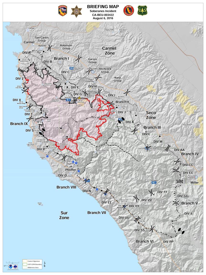
7:30 am – Facts sheet important details. Containment still 40%, acres up to 55,600. There is a burn out operation scheduled for today, but Cal Fire did not indicate where it would be, although I suspect it will be the one behind or between Post Summit and Mt. Manuel to protect Big Sur Valley.

6:00 am – I think I was remiss last night in not posting the facts sheet, or at least the acreage and containment. Acres is 53,900 – now up to 55,682 per IR flight before midnight – but containment is UP to 40%. YAY!! We are watching Big Sur Valley closely, today. Expecting a burn out operation this weekend, hopefully, if conditions are right, today. Another day of waking to no visibility due to smokey conditions. As always, I will be posting information here as soon as it is received, or shortly thereafter.

Soberanes Fire, Day 16, 8/6/16 – Maps, etc.

To give you an idea of where the Soberanes Fire is burning, we’ve included maps that are updated daily. These maps are provided by Cal Fire/US Forest Service.

The latest Heat Perimeter was detected yesterday at 9:25 pm.  You can see the latest Heat Perimeter on the Infrared Topo and Ortho maps.

We’ve also included the Weather Forecast, Fire Behavior Forecast and various links that you may find useful. Note: Additional links are located at the end of the post. Some links may open large PDF documents.

Please see Local Reports for the current fire discussion.

Infrared Topo: IR_Topo0001b.jpg

Infrared with Satellite Image: IR_Ortho0001

IR Loglog

Weather ForecastPDFtoJPG.me-1.jpg

Fire Behavior ForecastPDFtoJPG.me-2.jpg

Operations Map North: Ops North0001c.jpg

Operations Map South: Ops South0002.jpg

LegendLegend

Briefing Map: BAM0003

Public Information Map: PIOPDFtoJPG.me-1b.jpg

Links:

Xasauan Today Satellite heat detection discussion

Google Maps Adam Clark’s Google Map with most recent Dozer lines, IR flight overlay, and the Planned Fire Line. Note: You may need to be signed in to a Google account to view this link.

Mapping Support Same as above, but on USGS Topo Maps

MesoWest Weather stations that are located near the fire. Scroll down to S07 Central Coast IRAWS. See the Blue WX rectangles on the Ops maps for locations. There are currently 7 portable weather stations deployed.

Flight Radar 24 Live Air Traffic for the area.  Note: aircraft flying at low altitudes may not be detected.

Additional Cal Fire/ US Forest Service Links:

INCIDENT PLAN Complete Incident Plan as of 8/6/16. Note: PDF may take awhile to download.

IAP MAP CARMEL Dozer Carmel as of 8/5/16.

IAP MAP SECO Dozer Seco as of 8/5/16.

IAP MAP SUR Dozer Sur as of 8/5/16.

Air Operations Map

Air Operations HELCO Map

Firefighting Aircraft PDF guide with Cal Fire Firefighting Aircraft

SITUATION Situation Map as of 8/2/16 shows previous fire outlines

ELEVATIONS Elevations Map as of 8/2/16 shows hills and valleys in various colors

Soberanes Fire, Day 15, 8/5/16 – Local Reports

If you are going to  the clinic tomorrow, Saturday, with all the various agencies, and you have suffered during this fire, you might want to take advantage of this offer posted in my comments tonight: “Free Stress Reduction Clinic- Ear Acupuncture – Community welcomed – Sat August 6 noon – 4 pm at Community Church of the Monterey Peninsula – ? call Laurie Kleinman M.D .831 320-9560

7:15 pm – the smoke is horrific down here. I cannot see anything at all. I hope this is a burn out. This is bad. No sunset for me tonight.

5:30 pm – photo by Sandra O’Keefe Bellamy from Laureles Grade

image

2:45 pm – planes flying overhead from Paso going north to fire – maybe? Haven’t heard any more or any returns in quite a while (5:30 pm)

2:10 pm – Mt. Manuel by Barbara Sexton from Rancho Rico, who also notes a helicopter just flew over with a bucket. Hmmm…

image

12:30 pm – from Frank Pinney:

“I just got back from the 10:00 Cooperators Meeting at Toro Park, where Martha or I or Cal Fire Bn Chief Mike Martin serve as Agency Representatives for the Brigade daily.

Firing out on the east side of Mt Manuel at tactical points will begin Saturday or Sunday at the latest. Ops is allowing time to get the hand lines needed to help contain and direct the new fire that will be introduced by the hand crews that will reduce the probability that there can be a run uphill to reach the primary fire break uncontrolled.

Firing out is always tricky because they are placing new fire ahead of the main front, so the conditions have to right on target.

Hand line at Gorge highest priority and tie in to the North Coast Ridge Road Firebreak continues to be improved. Frank Zabrowski has tied in with Branch VIII Sur Ops to share historic local knowledge. Still planning to have a community meeting Monday at 6PM at the MAF depending on fire behavior over the weekend (fire ops looking very positive at this time)”

Frank Pinney
Chief Emeritus
BSVFB

12:05 pm – Oh, great. They have expanded the LPNF closure to Nacimiento-Fergusson RD on the south end, thus pushing all the hikers and campers down into our end. Why not close the entire Monterey District??? Now we have to deal with all the illegal campfires with only 1 ranger?? This is idiotic, and if I see Bob Baird on Sunday, I will tell him so,

image

11:30 am – Well, the OES alert system works, and I am signed up, I guess. Two phone calls and 1 email notifying me that the air quality in the Big Sur area, all the way down to the county line is unhealthy, and we are advised to stay indoors with window and doors closed. Okay, I knew that. I also know I can’t close my windows and doors due to temperatures. So there I am. I will get a respite for a couple days soon, though.

10:00 am – Working on widening Hopkins Ridge hand line today, I am told, which is the one down from Mt. Manuel to the Big Sur River gorge Micah mentions below.

9:00 am – from Micah Curtis: “The fire is on Santa Lucia Ridge which runs up from the Little Sur river to Posts summit they were dropping retardant on it yesterday to keep it from blowing up and over Posts Summit and into the valley. They are hoping to to get good conditions to backburn off the dozer, retardant line from the old coast road over Posts summit and mount Manuel they have a hand line from Mount Manuel down into the Big Sur river gorge. The line is unlikely to hold without the backburn, ….”

8:30 am – here is Xasauan Today‘s map: (not looking good for Cachagua or Big Sur Valley, although Cachagua was prepped for a big firing operation last night. The one for Big Sur Valley may have been canceled due to winds.)

image

Today’s update from resident of Post’s Ranch “…the fire is near Apple Pie now. Unfortunately a backfire was never started due to high winds so only retardant and heroic clearance efforts stand between fire and many homes including Melissa’s house right now (about 1 mile). She is packing and moving things up here (Post’s) tomorrow…. We have about a 3 day wait until the fire could be here. I am packing photo albums and made an evacuation list to pack if we get a warning. The air is thick with smoke but it’s ok inside. Planes and helicopters flew over us all day. They sounded wonderful!”

6:00 am – I remember when this used to be an ungodly hour for waking and moving about, never mind writing a cogent sentence. I am confident it will be again, just not confident about when that will happen.

Total acres 53,726

From last night taken by Cache Swanson from Jack Swanson’s Ranch:

image

Soberanes Fire, Day 15, 8/5/16 – Maps & IR Log

Google Maps link has been updated (you may need to be signed in to a Google account to view the link). This link includes up-to-date Dozer lines, IR flight overlay, and the Planned Fire Line. Dozer Maps are now located in the links below. See comments and local reports for current discussion. See Infrared Images for the updated Fire Edge (as of 11:27pm on 8/4/16 ). See Weather Discussion and Fire Behavior Forecast (below) for fire predictions. Map links will open full-size PDF documents. To ZOOM in from a desktop computer hold CONTROL and + (on mac COMMAND and +).

Satellite heat detection discussion here: Xasauan Today

Google Maps link: Google Maps (Adam Clark’s Google Map with up-to-date Dozer lines, IR flight overlay, and the Planned Fire Line all-in-one. You may need to be signed in to a Google account to view the link)

Mapping Support link: Mapping Support (same map as above overlayed on USGS topo maps)

Weather Information (blue WX rectangles, see S07 for IRAWS): MesoWest (provided by Larry)

Live Air Traffic: Flight Radar 24

Dozer Carmel: CARMEL

Dozer Seco: SECO

Dozer Sur: SUR

Infrared Topo: IR_Topo0002.jpg

Infrared with Satellite Image: IR_Ortho0001.jpg

IR Loglog

Weather Forcast0001

Fire Behavior Forecast0002

Operations Map North: Ops North0003.jpg

Operations Map South: Ops South0004.jpg

LegendLegend

Crossroads, Carmel: Firefighters and Equipment

The Soberanes Fire incident base is in full operation on the Rancho Canada golf course. As a result fire trucks and fire personnel dominate the parking lots of The Crossroads shopping center and businesses along Carmel Rancho Blvd. You won’t hear anyone complaining.

In front of Safeway there is a map station staffed by active or retired Cal Fire personnel. They answer questions about fire activity and help interpret the maps.

PG&E trucks have taken over the field at the corner of Highway 1 and Rio Rd.. They brought in heavy equipment to restore lost power and replace burned power poles. There were more than a dozen large construction oriented PG&E trucks and numerous support vehicles staged in the field at 6:00 am today.

Below are some street images taken August 3 on Carmel Rancho Blvd, Rio Road and Crossroads parking lot.

August3Fire9315

Most of the images taken yesterday represent engine strike teams heading out for the 12 hour day shift.

August3Fire9311

Strike teams from as far away as Calexico.

August3Fire9310

August3Fire9312

Strike team lined up for gasoline at the 76 Station.

August3Fire9321

Strike team from Mariposa on Carmel Rancho Blvd.

August3Fire9317

Exiting the incident base onto Rio Road.

Soberanes Fire, Day 14, 8/4/16 – Local Reports

8:45 pm – sunset from my observation post and a good night from Bigsurkate and Missy McNab, the mystery dog.

image

8:30 pm – As the fire grows (51.200 acres) so does the containment. (30%). I can’t tell you how impressed I am with this management team. I have been watching them closely for two weeks now, and their planning is the most advanced I have ever witnessed, and I have watched a few. If you witness increased activity in your area, chances are they are preparing a week in advance for the worst case scenario. I watched preparations on Chew’s Ridge via Tom Little Bear Nason for a week, and then watched the hard closures of the roads in the area earlier today, and knew a backfire operation would happen tonight to protect Cachagua. If all goes well (can’t always predict Mother Nature) Cachagua will be breathing easier in just a few days. They have saved White Rock this way, Rancho San Clemente this way, and they will save Cachagua and Big Sur Valley this way. This is a debt that can never be repaid. But here is an organization that provides for the fallen firefighters and their families, and maybe you can help pay your respects and thanks by donating to them:

Wildland Fire Fighters Foundation

6:00 pm – a message from from a friend in Big Sur Valley:

“The fire that was 14 miles is now right next door! Granted it is high on the ridge with a fuel break retardant dropped and dropping still in between. Just thought you would like to know how much fun it is getting to be.”

4:30 pm – for those who can’t go to  the community meeting tonight, and who are familiar with periscope (I am not, so can’t help you there)
“Please join us for the community meeting, live on Periscope at CAL FIRE BEU, or @lospadresnf and @CAL FIRE BEU on Twitter.”

Okay, I did get this link specific to the meeting off of Twitter, hopefully, it will work (caveat, I had to transcribe by hand to paper and then here, lots of room for error with those weird letter/number strings):

Periscope

3:20 – This was taken from the Big Sur Deli at 2:11 by Kurt?

image

1:40 pm – I find myself napping whenever I can. I’ll be back, but in the meantime, a reader sent me this:

image

1:00 pm – Firefighter Brett Gainey captured this insane photo on the Soberanes Fire

image

11:00 am

image

10:30 am – from the Big Sur Health Center:

1) Big Sur Health Center is a non-profit supporting the community during this disaster. BSHC is offering complimentary services to all those who are victims of the Sobranes Fire, whether due to loss of residence, loss of job, or just volunteering to help neighbors fight the fire and protect property. We know from experience that during times of stress, people tend to get sick and/or injured. We don’t want finances to discourage anyone from seeking services.

2) Big Sur Health Center staff is supporting the local firefighting effort by providing on-site evaluation and treatment of the firefighters at the Base Camp at Pfeiffer State Park. We are proud to be able to support these brave men and women.

7:00 am – Another Dawn with no sun, as the smoke is too thick. Breathing has become both a challenge and a goal.

I got many, many shots of the huge plumes yesterday late, that, from what I was told last night, was a successful back firing operation. I couldn’t get them all posted. Will try to do better this am, if you have shots from this morning.

For the first time since the fire started, a predicted change in the weather for the good, allowing for recovery of RH (relative humidity) at night is in the forecast. (See the weather report on the maps post).

From Rancho San Clemente:

image

To see the rest of the photos, go to their FB page.

Soberanes Fire, Day 14, 8/4/16 – Maps & IR Log

Google Maps link has been added (you may need to be signed in to a Google account to view the link). This link includes up-to-date Dozer lines, IR flight overlay, and the Planned Fire Line. Dozer Maps are now located in the links below. See comments and local reports for current discussion. See Infrared Images for the updated Fire Edge (as of 10:03am on 8/3/16 ). See Weather Discussion and Fire Behavior Forecast (below) for fire predictions. Map links will open full-size PDF documents. To ZOOM in from a desktop computer hold CONTROL and + (on mac COMMAND and +).

Satellite heat detection discussion here: Xasauan Today

Google Maps link: Google Maps (Adam Clark’s Google Map with up-to-date Dozer lines, IR flight overlay, and the Planned Fire Line all-in-one. You may need to be signed in to a Google account to view the link)

Mapping Support link: Mapping Support (same map as above overlayed on USGS topo maps)

Weather Information (blue WX rectangles, see S07 for IRAWS): MesoWest (provided by Larry)

Live Air Traffic: Flight Radar 24

Dozer Carmel: CARMEL

Dozer Seco: SECO

Dozer Sur: SUR

Infrared Topo: IR_TopoPage1B.jpg

Infrared with Satellite Image: IR_OrthoPage1.jpg

IR Loglog

Weather ForcastSoberanes_IAP-1.jpg

Fire Behavior ForecastSoberanes_IAP-2.jpg

Briefing Map: BAMBAM_E_20160803_2157_Soberanes_CABEU003422_opt-1.jpg

Operations Map North: Ops NorthOps_North_E_port_20160804_Soberanes_CABEU003422_opt-1.jpg

Operations Map South: Ops South0001

LegendLegend


Fundraiser at Golden State Theatre 8/12

Friday August 12th at 7 pm at the Golden State Theater in downtown Monterey
Acclaimed singer-songwriter Sharon van Etten w/ special guest Al Jardine (of the Beach Boys) and some very special guests.

Proceeds from the 850 still-to-be-sold tickets will to be distributed to the Soberanes Fire Relief Fund.

Residents who lost their homes will get free admission courtesy of Treebones. 💋

This is a chance to really help out! By getting together you will show your support for your neighbors in need as well as your support of the arts as a wonderful way for healing and health in our communities.

Ticket prices are: $35 (upper balcony), $55 (rear orchestra), $75 (lower balcony) and $100 (front orchestra).

Get your tickets here: Golden State Theater

or copy and paste this link into your browser

https://goldenstatetheatre.showare.com/eventperformances.asp?evt=116