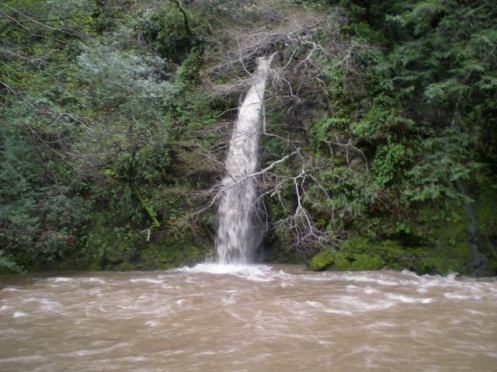
9 pm – it has been a long, interesting day. I am signing off for the evening, and will be back as soon as I have my coffee, get the gennie started, and get my day started in the am. Not going to be early, I don’t think. I’m getting a little tired. I’ve lost track, but I think it has been a week tomorrow. It started raining about an hour ago, but so far, relatively gentle, but now the wind is picking up. Great. Good night.
First, Pacific Valley School schedule for Weds. 3/23:
I’m forwarding the weather advisory that was emailed to us by Ron Eastwood at the Monterey County Office of Education. As a result of his email Raeanna at Pacific Valley School has decided to start school at
10:00 a.m. and be dismissed at 3:00 p.m. This is a safety measure to insure students and staff can arrive safely. If you feel as though the weather conditions are not safe we will certainly understand if you do not send your child to school. Some students have been sent home with home study packets so they should be continuing ahead on them. Since we’ll be starting at 10:00 we will not be serving breakfast but will serve lunch at 12:15 – 12:30 p.m.
Bus Times are: Morning Glory pick up at 9:15 a.m
Lucia pick up at 9:20ish a.m.
Cal Trans pick up at 9:50ish a.m.
Please adjust the afternoon drop off time with the bus leaving PV at 3:00 p.m. and heading south first then going to Lucia/Morning Glory.
Thank you for bearing with us during these winter storms.
Lisa Gering
**********************************************************************
Second, a flash flood watch has been issued. THE NATIONAL WEATHER SERVICE HAS ISSUED A FLASH FLOOD WATCH .. LOS PADRES NATIONAL FOREST AND SOUTHERN MONTEREY BAY AND BIG SUR COAST.
THIS IS IN EFFECT FROM MIDNIGHT TONIGHT THROUGH WEDNESDAY AFTERNOON.
*********************************************************************
And here is the “good” news (kate being facetious)
SATL IMAGERY IS INDC THAT THE SYSTEM OFF THE CENTRAL CA COAST (NEAR 37/129) IS MOVING ENE AT THIS TIME…AND IS INTENSIFYING.
MODELS BEGIN THE RAIN THIS EVENING…WITH THE RAIN BECOMING MODERATE…OR EVEN HEAVY AT TIMES OVERNIGHT INTO WEDNESDAY MORNING. EVEN THROUGH THE TPW`S ARE LESS THAN ONE INCH…THERE IS STRONG ISENTROPIC LIFT…WHICH IS PERPENDICULAR TO THE COASTAL MOUNTAINS. THEREFORE…RAINFALL RATES COULD BECOME EXCESSIVE. THEREFORE…A FLASH FLOOD WATCH HAS BEEN ISSUED FOR THE COAST AND COASTAL MOUNTAINS FOR LATE TONIGHT AND WEDNESDAY (ALSO INCLUDING THE NORTHERN SALINAS VALLEY). WINDS WILL BECOME GUSTY TONIGHT…BUT SHOULD REMAIN BELOW ADVISORY LEVELS. NEVERTHELESS…DOWNED TREES AND POWER LINES… ESPECIALLY IN THE MOUNTAINS WITH THE SATURATED SOILS ARE VERY POSSIBLE. THE NAM12 IS INDC A DECENT AMOUNT OF INSTABILITY WED AFTN AND EVENING…SO HAVE ADDED THUNDER TO THE FORECAST ACROSS THE DISTRICT.
RIGHT ON THIS SYSTEMS HEELS WILL BE THE NEXT UPSTREAM SYSTEM WILL BRING WARM ADVECTION RAINS STARTING WEDNESDAY NIGHT. THIS SYSTEM COULD EVEN BE STRONGER THAN THE SYSTEM TONIGHT/WEDNESDAY. RAINFALL COULD BE EXCESSIVE AT TIMES…SO IT WOULD NOT BE A SURPRISE IF ANOTHER FLASH FLOOD WATCH IS ISSUED. WINDS WILL BE GUSTY WITH DOWNED TREES AND POWER LINES ONCE AGAIN.


