6:15 pm – From local KSBW news feed on twitter.on twitter:


6:15 pm – From local KSBW news feed on twitter.on twitter:
Noon – Last anticipated update – they are calling this puppy contained. I got the following email from a source with FHL at 11:15 this am:
“Hey Kate…..the stoney fire got into the back drop off of redman an has burned over pizza hill…..they’ve got 4 dozers working it….from the burn side on nac-ferg an are opening old breaks from the kirk fire over to del venture….sounds like maybe gonna burn off from the break once they punch it in…..they said nac-ferg is still open [ed. note – The “official” word is that it is still closed, probably due to possible burn-out operation]….they also have engs from Monterey cnty helping out too…..SLO county hasn’t sent anything yet…also paso air attack has a 4 eng. job there now with 74 an 75….looked like a DC-6….probably forest service.
9:00 – Stoney Fire is reported at 5,000 acres according to WildCAD. Cal Fire reports the acreage at 4,800 with 50% containment.
8:00 – I am postponing Foto Friday until 5:00 pm, so that I can bring myself and my readers up-to-date on the fire at FHL. I had to will myself to sleep with the smell of smoke clogging my nostrils. It is amazing the memories triggered by smell – my mother’s perfume, a baby’s powder … The smell of smoke.
Word from several people of a large fire, 2500 acres, in Stoney Valley with no containment as of 10:30 pm. I can smell it from here.
There have been war games going on for the past two days, and one source said there have been a number of small fires, but that the FHL FD has been able to contain them rapidly. Not so this one.
One local was stopped at the gate in Jolon, while trying to get home at 9:30 pm, and not allowed to pass through, as the fire is interfering with Nasty-Fergy Rd.
I am having intermittent internet and email, but my phone seems to be working fine, just can’t hear it ring unless I am sitting on top of it.
Re: CA-FHL-Stonylink to satellite image
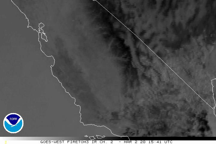
Showing up on the infrared satellite: http://www.ssd.noaa.gov/goes/west/wfo/hnx/ir2f.jpg
The smell of smoke up here is quite strong. It is now midnight, and I will be getting some sleep while I can. I will update in the am, internet and other communications allowing. If I can’t, I’ll see if Mike can cover for me.
Andrew Molera State Park Prescribed Burn 10/2013
What: California State Parks is planning to conduct a prescribed burn in Andrew Molera State Park in Big Sur.
When: Burning will occur after enough rain has fallen that the majority of the vegetation within drainages surrounding the burn plots will not carry fire, but grasslands and some coyote brush will burn at a low to moderate intensity. If meteorological conditions are favorable, this will occur during the second half of October through the first half of December.
Why: We are burning this project area in order to manage for native grasslands (Coastal Prairie) that exist within Andrew Molera State Park. This very diverse plant community is rare in California and has been largely replaced by European annual grassland, coastal scrub and chaparral. Our intent is to slow the growth of coyote brush and non-native grasses in parts of northeastern and southwestern Andrew Molera State Park (see map), where healthy stands of Coastal Prairie exist.
Who: This prescribed burn will be conducted by the California State Parks Central Coast Prescribed Burn Team. This crew has extensive prescribed burning experience in parks throughout the central and northern California Coast. Support will also be provided by at least two of the following agencies: Cal Fire, North Tree Fire/El Sur Ranch, U.S. Forest Service and Big Sur Fire Brigade.
Where: The 350 acre Molera Native Grasslands Restoration site is divided into 12 burn plots, which have been burned or will be burned separately (see map). This year we hope to burn Plots 6, 7, 8, 9 on the east side of Hwy 1, a total of approximately 70 acres.
More information: A Cal Fire Burning Permit, a Monterey Bay Unified Air Pollution Control District Smoke Management Permit, and a Coastal Development Permit have been issued for this project. In addition, a Mitigated Negative Declaration, a Biological Survey Report and several plant and animal surveys have been completed. If you have questions or comments, please call Jeff Frey at 384-0956.

From twitter about 11:30
CAL FIRE BEU
1 hour ago
CAL FIRE is planning a prescribed burn in the southern Diablo Range southeast of Pinnacles National Park (San Benito County) for Thursday, October 10, 2013.
Cal Fire says this is 100% contained as of 11:30 this am. Good job, ladies and gentlemen!
7:30 am – About 6 am this morning, a wildfire broke out at Highway One and El Toro Crrek. (Near Cayucos) It was 50 acres and spreading in rough terrain. Currently, it is 100 acres, and 30% contained. The IC (incident commander) called for more air attack, as access is difficult. Power lines are down. SLU (San Luis Cal Fire) SLO City have all been called in. BEU (Monterey/San Benito Co) Cal Fire are on the way to provide backup on the fire and by covering the SLU stations. I will be monitoring this until it is contained.

Photo by Meredith Gafill from Nepenthe.
2:20 pm – fire contained. Woohoo! Thanks for that, Kimball.
I have very few details, but USFS fire department on scene and others on way. USFS reports power lines down. from scanner listener…just heard forest service dispatch units to a fire on hwy 1 at marker 44….B 12, Engs. 15, 16, 31,38, WT 4, crews 3 & 7, PT 7 & 12, C 527 an 528
A collision between a big rig and a vehicle started a wildfire between Aromas and San Juan Bautista. Both drivers received major injuries. The Highway is expected to stay close until about 3:30 pm.
1:22 pm – “@CalFireNews: #MissionFire made many rapid runs in north on east facing aspect with multiple spotting. Threat to private residences #CaFire”
12:45 – Monterey County Type 3 Strike Team en route to Mission Fire.
11:45 – just checked WildCAD, LPF, and they are reporting 4500 acres.
11:00 am – It is quite smoky over here. In fact, i can barely see Cone Peak. I have been trying to get updates on this fire, but having trouble. FHL doesn’t report publicly, like other agencies, so it is difficult. Do have a call out I’m waiting on, and will update when I hear.
From South Ops and New and Notes this evening:
2,500 acres, 25% contained.
Fire is spreading and continues to shift with weather patterns.
Fire made many rapid runs in north at an east facing aspect with multiple spotting.
Threat to private residence north at Pulman Canyon approx. 1 mile away on Avala Rd.
Evacuated radar site and military training areas off of Del Venturi Rd.
Update from a ff: “UPDATE as of 4:30 p.m.: the burned area has grown to 2,500 acres with no containment. About 200 firefighters are on the scene, from CalFire, the U.S. Forest Service, and others from across the region. No roads are closed or threatened at this time. Nacimiento-Fergusson Road to Highway 1 and the coast is open and should be clear of smoke as it is upwind.”
smoke drifting to north, visible in Chachagua. Beginning to see smoke from here, but I have a friend spotting for me from east of the fire, and he will notify me if the wind changes direction.
4 pm update – It is up to 1100 acres. SLO cty sending strike team 9341G that has B 3414, engs. 3461, 3472, 3465, 3466, an 3480 to the Ligg
Don’t have too many details. Fire on FHL in the Milpitas Shower Point area, and/or Mission CreekArea. It was reported to me about 11:45 am. Around 2:30, a LPF unit was dispatched to the Mission Fire on Mission Creek Rd. these two areas are very close together, so chances are they are the same incident. I’ll keep eye and ear out over this one, as FHL, as well as many other stations have engines up on the Rim fire near Yosemite, which grew 37k+ acres overnight last night. It is a nightmare.
BTW, can’t see any smoke from here, so can’t be too big.
This is what WildCAD says:
08/22/2013 11:24 FHL-2679
PFHW41 (1502) MISSION Wildfire Milpiltas Rd. and Mission Creek Rd. . BC11LPF CRW7LPF E15LPF 4X4 E16LPF 4X4 E18LPF E2565AZ E37AZ E43LPF E563AZ . . 100 acres.