6:00 pm ish – ROAD HAZARDS -CHP reports: Traffic Hazard reported at Palo Colorado Cyn., a large truck and trailer in road around 5 pm with no cones or emergency flashers. At 6:08 pm, a 100 lb limb is reported “hanging” over the road near Soberanes Point. And then there is the one below.
Sycamore Canyon Rd. blocked by tree. Photo by Belinda Shoemaker:

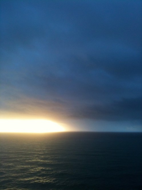
Here are two more “storm photos” — both sent in by Mike Gilson. The first is last night’s sunset:

This Big Sur river shot is from Wednesday (today) at 10:00 a.m. just after the storm cell passed…and the photo is looking upriver from the Hwy 1 bridge at Pfeiffer State Park

Nexrad is showing two more storms to hit our coast this afternoon. Others may be (and probably are) out of range of Nexrad.
Today’s Big Sur River Photos, courtesy of Debbie Reed:


She had this to say: “All well, river wise. Lots of redwood branches down. Good thing my car wasn’t there this a.m. during the gale wind. Would have damage. My power is out with limbs on lines. River doesn’t want to go down yet. Lucky we have theses breaks in the rain.”
11:00 am – it has become very quiet up here. Little wind, no rain … ah peaceful!
9:30 am – THE NATIONAL WEATHER SERVICE IN THE SAN FRANCISCO BAY AREA HAS ISSUED A
* SEVERE THUNDERSTORM WARNING FOR…
MONTEREY COUNTY IN CENTRAL CALIFORNIA…
THIS INCLUDES THE CITY OF BIG SUR VILLAGE…
* UNTIL 1000 AM PST
* AT 924 AM PST…NATIONAL WEATHER SERVICE DOPPLER RADAR INDICATED A SEVERE THUNDERSTORM CAPABLE OF PRODUCING DAMAGING WINDS IN EXCESS OF 60 MPH. SMALL HAIL AND DANGEROUS LIGHTNING. THIS STORM WAS LOCATED NEAR BIG SUR VILLAGE…AND MOVING NORTHEAST AT 40 MPH.
Here is that cell on Nexrad:


* OTHER LOCATIONS IN THE WARNING INCLUDE BUT ARE NOT LIMITED TO ANDREW MOLERA STATE PARK…PICO BLANCO CAMPGROUND AND CACHAGUA NEAR THE LOS PADRES DAM
9:30 am – rain totals: 2 inches overnight and this morning until 9:30 am; 10 inches for the week; and 36.6 inches for the season.
8:30 am – current Rextad – I claim lack of sleep — that’s Nexrad!!

5:30 am – thunder and lightning are WICKED right now! Thunder starts rolling the moment I see the flashes, and cracks a mere second later. If it wasn’t for the panicking dogs, this would be fun! Hmmm…almost.
4:15 am – Ommpf!! My sensitive canine kid jumped into the middle of my belly. No way was she going to go through this AGAIN, with me asleep. As soon as there is a break in the weather, I am getting some of that Rescue Remedy.
So, wind (not too bad), thunder & lightning (also not too bad) and moments of rain at this gawd-awful time of the morning.
Excepts from this morning’s NOAA forecast discussion:
AS OF 2:50 AM PST WEDNESDAY…SHORT TERM ISSUE INVOLVES BRACING FOR THE NEXT STORM SYSTEM DUE TO SLAM ONTO THE COAST BEFORE DAWN. ANOTHER SYSTEM IS SLATED FOR THURSDAY WITH QUIETER WEATHER FOR THE WEEKEND.
… HEAVIER RAINS ASSOCIATED WITH THIS FRONTAL BAND WILL LIKELY MOVE THROUGH DURING RUSH HOUR…SIMILAR TO YESTERDAY`S FRONTAL PASSAGE. IN ADDITION TO THE RAINS…STRONG WINDS ARE FORECAST TO ACCOMPANY THIS SYSTEM AND WIND ADVISORIES AND HIGH WIND WARNINGS HAVE BEEN POSTED FOR COASTAL AND MOUNTAIN AREAS AS WELL AS [SOME] INLAND VALLEYS…WIND SPEEDS ARE EXPECTED TO EASE AFTER NOON…AND IMPROVING CONDITIONS IN GENERAL CAN BE ANTICIPATED. HOWEVER…SHOWERS AND THUNDERSTORMS WILL REMAIN POSSIBLE IF NOT LIKELY IN THE UNSTABLE POST-FRONTAL AIRMASS. SOME THUNDERSTORMS COULD PRODUCE SMALL HAIL.
… ADDITIONALLY…HEAVY RAIN IS EXPECTED TO ACCOMPANY THIS STORM SYSTEM WITH AN ADDITIONAL 1 TO 4 INCHES OF RAIN ANTICIPATED THROUGH THE AFTERNOON WITH THE HIGHER AMOUNTS EXPECTED ACROSS HIGHER TERRAIN.
… ANOTHER STORM SYSTEM IS FORECAST TO IMPACT THE STATE ON THURSDAY AS AN UPPER LEVEL LOW CENTER MOVES ACROSS CENTRAL CALIFORNIA. RIGHT NOW THIS SYSTEM IS EXPECTED TO PARTICULARLY IMPACT AREAS FROM ABOUT BIG SUR SOUTHWARD WITH THE HEAVIEST RAINS THERE AND INTO THE LA BASIN BY THURSDAY AFTERNOON. QPF ESTIMATES FOR OUR DISTRICT GIVE 1-3 INCHES IN THE SANTA LUCIAS…UP TO AN INCH OR SO IN THE SANTA CRUZ MOUNTAINS…AND A HALF INCH OR LESS ELSEWHERE THROUGH FRIDAY MORNING.

