


More photos later.

More photos later.

Pano with help from local, Hope.

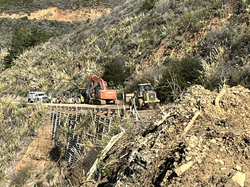


The best part of the trip was probably seeing several of my neighbors out working on the road making sure it was passable! Thank you all! My community is amazing. We don’t wait on the agencies, we help ourselves and each other. Rock Knocker even stopped on Nacimiento and redirected some water that would have ended up undermining the road if it wasn’t diverted to a better path, and we waited and watched to make sure it worked. Here are just a few photos I took. I have an article I have to write today, an interview with a reporter for the NYT, and so much clean up to do I don’t know where to start! Oh, and we were stopped by the FHL police who was making sure who we were, where we lived, where we were coming from and making sure we knew the road was closed. I will be adding a few more throughout the day. These are chronologically ordered, so the new ones I add will be on the bottom, if you revisit this evening.
The rivers shown are the Nacimiento River and the Salinas River.


BEautiful, beautiful sunshine! The front deck is icy. BIll managed to punch through a slide on the back side (north of Los Burros) of South Coast Ridge Rd. and the horse dude just called to let me know the ex is on his way over to pick me up so we can do a yo-yo run to King City to restock! Looks to be snow on Cone Peak. And the South Coast, in our usual fashion, is already talking about a party when this winter of storms is over.
| Date: | Monday, January 16, 2023, at 5:00 p.m. |
| District: | 05 – Santa Barbara, San Luis Obispo, Monterey, San Benito, and Santa Cruz Counties |
| Contact: | Kevin Drabinski or Alexa Bertola |
| Phone: | (805) 549-3138 (805) 549-3237 |
FOR IMMEDIATE RELEASE
UPDATE #16
NORTHERN CLOSURE OF HIGHWAY 1 CONDITIONALLY SET TO MOVE
SOUTH TO LIME CREEK ON TUESDAY JAN. 17 AT 2:00 PM
MONTEREY / SAN LUIS OBISPO COUNTIES – With drier weather in the forecast, Caltrans is planning to move the northern closure limit of Highway 1, from its current location at Deetjen’s Inn (PM 43), south to Lime Creek (PM 32), on Tuesday Jan. 17 at 2 pm.
The scheduled move of the closure is conditional.
The northern limit will move south provided that Tuesday morning inspections of the roadway reveal that the road is safe for the travelling public.
Should morning inspections reveal that the road is safe to travel, the northern limit will move to Lime Creek on Tuesday Jan. 17 at 2 pm, offering additional access to the coast from the north.
Please note that, during forecasted rain events, the closure will be restored to the northern closure point at Deetjen’s.
It is anticipated that a resupply convoy, such as the one that took place on Friday Jan. 13, may be able to be scheduled in the coming days as road and weather conditions permit and crews are able to clear a path.
The road has sustained new damage in several areas which will need to be assessed to determine when a convoy may be viable, and if there may be a necessary reduction in the areas through which the convoy is able to travel. Updates will be provided as these assessments provide more information.
The southern closure of Highway 1 will remain at the elephant seal viewing area, four miles north of San Simeon.
A significant slide, one mile south of Ragged Point, at a location known as Polar Star, extends over both lanes of travel. The highway is impassible at this location and is expected to restrict access to Ragged Point from the south for several weeks to months.
Note: It is not permissible or safe to go across the slide area at Polar Star on foot. The public is asked to refrain from approaching the area surrounding this slide.
With clearing weather, a contractor will be mobilizing at Polar Star tomorrow and technical assessments will continue.
Road information and updates can also be found on Caltrans District 5 Social Media platforms: Twitter at: @CaltransD5, Facebook at: Caltrans Central Coast (District 5) and Instagram at: Caltrans_D5.
Our crews deserve to get home safely too.
Drive slowly and carefully in work zones.
Willow Creek, photos by Brendon Shave, taken this afternoon around 3:30


Photo by Connie McCoy, this is the drop Caltrans referred to in its update last night near Morning Glory.
“This photo was taken at noon on Sunday north of Lucia at PM 23.5 where CalTrans reports the drop in the road in its latest report.”

| Date: | Sunday, January 15, 2023, at 3:30 p.m. |
| District: | 05 – Santa Barbara, San Luis Obispo, Monterey, San Benito, and Santa Cruz Counties |
| Contact: | Kevin Drabinski or Jim Shivers |
| Phone: | (805) 549-3138 (805) 549-3237 |
FOR IMMEDIATE RELEASE
UPDATE #15
NEW SLIDE ACTIVITY ON HIGHWAY 1 WITH ASSESSMENTS TO CONTINUE
MONTEREY / SAN LUIS OBISPO COUNTIES – Caltrans continues to make assessments at numerous locations on Highway 1 which are showing significant instability as a result of an ongoing rain event.
There is a new slide at PM 18, just south of Mill Creek, which has covered both lanes of the roadway. The gates at Paul’s Slide at PM 22 remain locked and recent activity there has moved sections of the catchment area’s concrete barriers into the center of the roadway. Crews are also responding to an area north of Lucia at PM 23.5, where a lane there has settled over a foot in the last two days. A new closure is in place at that location known as Morning Glory.
In addition, there are multiple locations within the closure area which are exhibiting activity and, in some cases, distributing material across the roadway or undermining the road.
Caltrans has resident crews within the closure area. These crews are conserving supplies as a result of this extended period of storms. Even during these storms, crews have continued to respond, and are making daily evaluations of the roadway.
It is anticipated that a resupply convoy, such as the one that took place on Friday Jan. 13, may be able to be scheduled in the coming days as road and weather conditions permit and crews are able to clear a path.
The southern closure of Highway 1 will remain at the elephant seal viewing area, four miles north of San Simeon. A significant slide, one mile south of Ragged Point, extends over both lanes of travel. As a result, the highway is impassible at this location and is expected to restrict access to Ragged Point from the south for several weeks.
Road information and updates can also be found on Caltrans District 5 Social Media platforms: Twitter at: @CaltransD5, Facebook at: Caltrans Central Coast (District 5) and Instagram at: Caltrans_D5.
Our crews deserve to get home safely too.
Drive slowly and carefully in work zones.

Slide just SOUTH of Mill Creek (I made a mistake this am)
After a wild and crazy night with high winds, pounding rains, and lightning, it is a quiet, calm morning (albeit a cold one here at 39º) so after taking care of the dogs and starting my own breakfast, I am building a fire once again. It is my understanding (and hope) that we are to have a quiet morning, so I am going to take advantage of that. I’ll be back later today, unless something breaks loose in the meantime.
Advisory: Evacuation Warnings Upgraded to Evacuation Orders for areas of Carmel River Effective Immediately | Advertencias de evacuación se elev …
Dear Nixle User,The Monterey County Sheriff’s Office has upgraded Evacuation Warnings to Evacuation Orders for low-lying areas of the Carmel River effective immediately and until further notice. The Evacuation Order includes the following areas of the Carmel River North of Klondike Canyon Rd/Carmel Valley Rd and South of Rancho San Carlos Rd. If you are in an Evacuation Order Zone quickly and calmly evacuate. Check with your neighbors to ensure they have been made aware of this alert. If you have large animals or need extra time to evacuate, now is the time to do so. Monitor local media, social media, and Nixle alerts for updates. Call 2-1-1 for information. Call 9-1-1 only if you have a life-threatening emergency. If you need animal sheltering, call the SPCA at 831-373-2631. For the SPCA after hours line call 831-646-5534 An Emergency Shelter is available for residents in the Monterey Room at Monterey County Fairgrounds located at 2004 Fairground Rd, Monterey, CA. A Temporary Evacuation Point is located at the Carmel Valley Library from 8am-5pm. To view an Evacuation Map: bit.ly/3Za0Xc0
