Soberanes Fire, Day 8, 7/29/16 -Local Reports

9 pm – A couple of breaking news items from two different very trusted sources:

First, a burn out operation is planned for the OCR area by Mary’s place – the 4 cabins by the bridge. There is a fire truck stationed at each house. It is scheduled for tonight.

Second, They are in the process of building out a new base camp. It’s on the Rancho Canada Golf Club, west course, right behind Carmel Middle school. Moving from Toro park. Dozers are forging a new road as we speak. Can hear it from my house right now. It’s the old Holman Ranch property.

4;45 pm – Another slide show with some wonderful photo by Eduardo Blas of the Sam Remo area of the Carmel Highlands. Pay attention to that second photo, there is a little tiny firefighter climbing straight up!!~

This slideshow requires JavaScript.

3:00 pm -This series of slides shows a staging area at White Rock Carmel Valley for structure protection and a firing operation on the top of White Rock Ridge. As you will see the state and local resources responded over the past 6 days with Hot Shot crews Hand crews, Type three off road fire engines, Dozers and water tenders.

A type 3 Strike team consists of five similar engines with 3 personnel each and a Strike Team leader for each group of five. The type three engine as you can see is a very capable piece of equipment to take on fire in the wild land off road. The Dozers will open up the green area to stop the fire spread. Hand crews improve what the Dozers cannot get to. The Hot Shots will take on fire as needed with tools to stop the spread or again to improve
fire breaks. The firing operation again is to remove fuel and improve the fire break.
Best left to a very capable crew! I hope this helps, it has been a busy week for me.

Joe Pagnella

This slideshow requires JavaScript.

12:30 pmimage

From Erin Gaffil:

Tom and I are offering a limited edition print with 100 per cent of the proceeds going directly to victims of this terrible fire. We have already sold almost 1/3 and if we sell out we will offer another image as needed. Go to http://www.eringafill.com to purchase the print. Please share this post with everybody on your list!

image

From Lisa Kleissner and CPOA:

During the Basin Fire of 2008 and the Pfeiffer Fire in 2013, CPOA was able to help address some of the financial needs of the community through donations received from neighbors and friends of Big Sur. CPOA has begun to receive donations earmarked to help those impacted by the Soberanes Fire.

CPOA has just added Loss Assessment forms to the home page of their website (cpoabigsur.org) for folks impacted by the Soberanes Fire. Please download and complete a form and either email it to us at info@cpoabigsur.org or mail it to POB 59, Big Sur 93920. Any information provided will be strictly confidential. We will use this to determine needs and develop a strategy to equitably distribute the donations received.

If you have questions, please email info@cpoabigsur.org.

From Michael Troutman, taken yesterday over Palo

image

Black Heart. Says it all, doesn’t it?

8:30 am – Cal Fire photo

image

8:00 am – from John Chesnut:

imageimage

6:30 am – back on duty, gathering info, but brain still foggy. Post in the comments info you have that you want to share, send any photos from last night or today, hug your pets. They are anxious because you are anxious.

Soberanes Fire, Day 7, 7/28/16 – Official Reports & Maps

7:30 pm – Evening Facts Sheet

image

8:15 am – Facts Sheet (sorry it was late, I uploaded it, but forgot to undate the post before I left for the day)

image

7:45 am – Today’s briefing map:

image

7:40 am – Official PIO tweet has fire at 27,326 acres and 10% containment.

7:30 – Operations Map

image

7:25 – Today’s IR topo map: (Facts sheet should be out soon)

image

Soberanes Fire, Day 7, 7/28/16 – Local Reports

BEST NEWS TODAY CONFIRMED:

“The [mechanized equipment] request was approved 90 minutes after the fire went into the LPNF. USFS worked hard in the early days to get all of that ready in case it came into the forest. What Bill Monning announced was that the Federal Management Assistance Grant (FMAG) was approved by FEMA – which provides reimbursement for state and local costs and recovery money.” Kathleen Lee, assistant to Supervisor Dave Potter,

From tonight’s Community Meeeting, partial notes:

Q: how confident are you in lines protecting CV? A:Last 5 years fire has been extreme which is why trucks are coming. direct on fire in DivC and creating 2nd line on RSC road & 3rd line on Chamisal ridge

Q What part of cv is most vulnerable? A: Robinson Cyn, Garzas, RSC. Hitchcock & other remote steep outlyers

Q: Update on Palo & Garrapata? A: Hard area. Structures lost. Damage team not able to get in yet. Intensity off charts 2 prior days, cooler today & some progress.

Q: Palo fire movement direction? A: generally backing west, south into little sur drainage, burning downslope . Moving twd bixby creek, backing down twd palo creek in road corridor. SOD logs light, burns fown…

Wants more general questions

Q: containment size & date A: % is relative. Projected date is Aug 31 now cause he knows more than he did

Q: Communicating w/absentee landowners, gas service? A: register w/reverse 911 and turn off your own gas. Help your neighbors. Feeling ‘very comfortable @ CH.

Q: What is up north of skinners, mt carmel, poinciano ridge & pine valley? A: structure protection first. Working on that long term w/ midelling

Q: No plan to close shelter if there is a need but nobody currently usong it. can be opened again immediately if reqd

*******************************
Sobranes Fire Conference Call Presentation
July 28, 2016 3 PM

Presenter: Chief Michael Urquides, MCRFD
Moderator: Forrest Arthur (The Preserve)

On the Preserve there are currently 40 fire engines, 20 bulldozers (at the end of the conference he said 30) and over 300 correctional fire inmates. There are 8 helicopters, 4 fixed wing air tankers.

As far as those that have been evacuated expect to be evacuated a minimum of 5 days. They look at it with 5 day blocks. They will have a better estimate after the weekend.

Williams/Trapper Area:
There are 4 areas currently involved. The Williams Canyon/Trapper area is most active currently. The others are Garzas, Spill Area and White Rock. In the Williams/Trapper area (what we saw last night) it is what they call a backing fire, a planned fire slowly backing down to containment by design. They are close to putting crews in to fight it on the ground. The fuel is not very volatile and the humidity is higher than expected. It is not too destructive. The upper fuel is not being involved at this time (top of trees). The conditions are great for the ground litter to burn. The fire has not yet jumped the containment lines at Williams Canyon but the concern is it is not big enough to contain it. They are not worried if it goes to Rancho San Carlos. Great break there. The helicopters are currently making drops in this area and will do so until sundown as they did yesterday.

Rear of Garzas:
This area is not volatile, just ground litter burning. Properties are defensible.

Spill Area:
(approximately 1 1/2 miles due west of the intersection of San Clemente Trail and Robinson Canyon Rd.) The fire is active, 4-5 acres here but not scary. It did jump the primary dozer line in this remote area. Strike teams and dozers have been dispatched to this area to begin the installation of secondary containment lines. This outbreak does not endanger any homes at this time.

White Rock:
One concern is containment for the fire. Rancho San Carlos Rd. is one large break. One concern is the fires burning on the E side of White Rock Mtn. and getting into canyons in the Valley (Hitchcock and Robles Del Rio areas). For this reason they are staging 150 fire trucks in this area. Other containment lines are CV Rd. and Highway 1. They are doing long term planning here, more rather than not enough.

Other General Information:
The weather is cooperating for troops on the ground. This is the number one fire in the nation now and there aren’t other big fires happening now. They have requested and are getting everything they have asked for. There have been no delays on the requests. This fire has already gone over $40 million to fight it, 4-5 million a day. The biggest cost is aircraft but the daily cost goes down when they are grounded because they are contract employees. 4,000 fire fighters are assigned to fight this.

There are trucks in every driveway of the preserve. This is precautionary. They are checking for embers. They have 20,000 feet of hose laid out. All hydrants on the preserve are used for top offs. Another concern is when the smoke clears the sun is out and makes things volatile. Fighting this is a delicate game. They can’t underestimate the fire and take it one day at a time. There is a lot of save haven in the preserve which is why they have so many fighter in there. They are able to make big containment areas rather than little island containment areas. The Preserve is like a little fire city with equipment. They prepare for the worst but hope for the best.

Regarding the maps which are developed by Intel they are done at 4 PM for fighting the next day. They are already 12+ old the next day. They also use a Type 3 Helicopter so they can have a better picture but the smoke makes that difficult too. The Incident Commander goes up in this to get a better picture for fighting the fire.

Fuel burning slowly is defensible. It will be smoky.

A note on the bull dozer operator that was killed. This was almost the same spot the previous dozer was killed.
There was an email address to send questions but it was given so quickly I didn’t get it. Forrest Arthur asked Chief Urquides questions residents had sent in. I will try and get that to you.
There is a community meeting at CMS tonight at 6 PM. I will attend and relay any new info.

Incredible community up here on the mountain!
Aletha
_____________________________________________________________________________________________MCRFD Add’l notes from same meeting by Lucas Ryan. Note costs at end, and prior dozer death at same location in 2007.

Chief Urquides

40 trucks and 20 Bulldozers at The Preserve.

5-day evacuation blocks at this moment. Not long term. Wait through the weekend. 5-day windows of opportunity.
Global picture – 4 quadrants
Williams canyon – Trappers – Garzas area: backing fire. planned fire couldn’t go direct because of ridgeline. By design. Eventually, FF will go in to put fire out. Fuel not volatile, humidity higher. Fire not backing down into rancho san carlos contingency road area. Fire not destructive to upper fuel bed, all duff driven, win win to keep fire out of trees – ground crews – conditions are great to just burn ground litter and not upper canopies.

Garzas – Fire close to the rear of the Garzas. Smokey conditions. Not volatile, A lot of FF’s doing great work. They are confident properties are defensible.

Spill area 1.5 mile west corner of San Clemente trail and Robinson – 4-5 acres contingency lines. Jumped Whiterock dozer line. Trucks on RSC road, concern is embers from backing fire fall onto west side RSC south facing grass.

CV village – Fire Dept. Big Box Line, CV road, Hwy 1, Cachagua. If the fire continues to loop around Whiterock, San Clemente, the canyons could align to CV village – Hitchcock Canyon. Don’t have any definitive fire breaks but are trying to put them in as we speak. They want to do long term planning – overplanning. FF’s in village proper, Hitchcock, Robles. New order for 150 truck for this area. Not much fire in western united states, #1 incident, so they are getting what they are asking for. Error side of caution because of severity of fuels. Weather is cooperative for troops, but not for airplanes. Sun will ripen the fuel to become volatile. Trying to get as much work done as smoke allows – without aggressive use of aircraft. Delicate game. CAN’T UNDERESTIMATE THE POTENTIAL OF THIS FIRE One day at a time. Calling for a lot more resources to be over prepared.

Entire Preserve effected? Pre-planning box – can’t undercut backside of preserve planning fire or division breaks, we include the whole Preserve. A lot of safe haven, we can stop from aggressively getting to Chamisal, but don’t want to make islands. Planning so it will not impact more than it has. Prepare for Worst, hope for best, calling a lot of resources to protect infrastructure of Preserve. Picture little fire city. Overplan, request resources in case the fire takes off. 5 day segments for evacuation, Maps – intel in at 4pm, 12 hours behind for fire data when they come out. Commander has type 3 helicopter to fly fire, but with smoke they can’t do that. Maps are a concern for FF’s and Public.

Proximity to RSC and the trappers. It is close. Slow, Smokey, no aggressive wall of fire. FF’s are confident. Defendable for any structures there.

Fire Fatality, 2007 Matt Will, the recent accident, Robert Reagan, was 1/4 mile from where that occurred. Last Dozer fatality was 2007 in the same spot. Just shows it is steep. Dozers are an amazing tool, but when you can’t go direct it causes challenges. 60 Dozers assigned and 30 on the preserve to safeguard homes.

Appreciative that the homes were protected in the Garzas, but 4 homes on West side RSC, 35, 39, 42, 44. They look great. Trucks in driveways to prevent embers falling in grass. Cache of hose – 20,000’ of hose pre-staged along RSC, water system working great, hydrants in service. Life first and then protect the environment. Nothing precludes us from protecting those homes.

Has fire jumped containment lines Williams canyon? It has not jumped, but we question the fire line strength. If it does jump then it’ll be at the bottom. They prepped BSLT cabins, the fire burned around, it is secure. If we can protect those cabins then we can protect homes. We will see fire from Williams canyon to RSC road by backing or FF will put fire on the ground to secure that line.

Any known cost of the fire? $40 million, 4-5 million a day fire. Cost is down because of aircraft – they can’t fly. When they can’t fly they don’t get paid.

Photo from Saddle Mountain looking toward Preserve, photo by Aletha


image

This evening from Clear Ridge, photo by Jen Smith

image

3:00 pm – From Michael Troutman

image

9:15 – A GOFUNDME account has been established for the wife and two daughters of the dozer operator who lost his life, Go fund me for Robert Reagan

A friend of Michael Troutman’s (ex USFS hotshot) found this amazing video. It is shot from inside the cockpit of a tanker. The green dots on the dash are the retardant level

Retardant drop (It has been taken down)

5:30 am – asked to let you know about this organization:

“July, 2016. Monterey, CA. The Community Emergency Response Volunteers (CERV) of the Monterey Peninsula, a 501c3 non-profit, has launched MontereyCo.RECOVERS.org in response to the Soberanes Fire recovery efforts. The website is overseen and staffed by Recovers Squad volunteers from CERT programs in Monterey, Seaside, Marina, and Pacific Grove. The website, https://montereyco.recovers.org, is a tool to build community resilience by matching people’s needs with resources in the community at a grass roots level. Local organizations and community members with specific needs as a result of the Soberanes Fire are invited to register and post on the site.”

5:00 am – had company stop by LAST NIGHT, with some lovely Holy Granola and honey from the Hermitage (thanks to all the monks for this) and a couple bottles of wine, and we shared stories and wine for a couple hours, it was a nice break last evening.

Today, after an exhausting 6 days, I will be taking some time off and will be off line from 10 – 2, while Mike Morales will be keeping an eye on the blog for me, and moderating comments, etc. I am taking Rock Knocker out to lunch in the Big Sur Valley for his birthday (it was yesterday) which will allow me a closer look at things up on the North End, and an opportunity to get a feel for what people’s concerns are, and where any help may be needed. During travel time and during lunch, I will not be monitoring, but before I leave, both home and lunch, I will check in.

In the mean time, I will be uploading my daily dozer maps when I get them, and other information that may be of help. One note I would like to make is in the comments people leave seeking information from others, these comments are often left in all sorts of different places, which will be hard to find, for example, one person waning to know about a specific place on Day 6, left a comment on Day 3, which is not likely to ever be seen by anyone now, 3-4 days later. Might I suggest those kinds of comments are best posted on the “locals” post for the day one is asking the question? More likely to be seen. Some great summaries and observations came out of last night’s summaries, but they are spread out among Day 6 posts.

One of the things I learned in covering fires for this blog is that I can get “up and running” and “up to speed” in an hour, whereas most sources of information might take days. That first week is critical in knowing what is going on. As “official” sources become more available, and more information becomes available through all sorts of sources, my blog becomes less critical and thus I can begin to slow down. I couldn’t possibly humanly keep up the pace I have been devoting to this until the end of August, the new containment date, so beginning today, you will start to see a slow down in the amount of information offered.


Panorama from Mescal Ridge

This amazing photo taken at 4:30 this afternoon by Mark Readdie who JUST got home He explains it for us under the photo. This is probably my favorite shot of the day, but absent a catastrophe, my last post today. I am more tired than I’ve been since the Chalk Fire of 2008, and then I didn’t have to do FB or Twitter.

image

Kate,
Here are some observations.

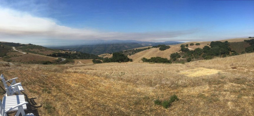
Panorama photo from Mescal Ridge, downhill of Bonifacio Hill. On the right are Pico Blanco and Bixby Mountain. On the left looking out to Long Ridge, Green Ridge, etc.

Bixby Mountain and Mill Creek Preserve have burned and fire is in Bear Trap Canyon. The spot fire is down to the Little Sur River west of Pico Blanco. Three Calfire dozers are on Mescal Ridge above the Moon’s. I saw a number (6?) dozer transports parked at Andrew Molera. Their flagging was on a gate just south of the Old Coast Road.

Helicopters were dipping in the Moon’s pond this afternoon trying to save houses between Rocky Creek and Garrapata. Wildland crew and dozer structure protection activity in that area was observed with binoculars.

Dozers have opened the line along Long Ridge. Word is that they have gone along Skinner Ridge too. LPNF scout showed up this afternoon. Let’s see what they can do around Pico Blanco.
Mark

A message from Kate Healy around 9:30 was that her three kids had called and were up the with Warren (who contacted my at 6:34 am Sunday to report the Bixby Spot which I called in to 911) are up there with some regular firefighters taking on the fire as I post this.

Soberanes Fire, Day 3, 7/24/16

From State Parks:

“We just had a meeting where the decision was made to close Pfeiffer Big Sur to day use as of sundown tonight. Current campers are being told they need to be out by noon tomorrow at which time the Pfeiffer Big Sur State Park will be totally closed.”

Mandatory Evacuation Orders Expanded

image

From Micah Curtis a few moments ago:

“Kodiak is at the Bixby ranch and says that the fire is creeping down into the north fork of the Little Sur drainage doesn’t see much fire fighting action. If the fire gets around Pico Blanco into the south fork of the Little Sur very good odds that it will crest the ridge above Big Sur Valley in a couple days. People in the valley should double down on their fire clearance. We have dozed out our fire breaks but midslope breaks are not that good.. Micah Curtis.” Okay, can I have a drink, now?

3:30 pm – the latest Fire Map at the Highlands Fire Station:

image

New MODIS from John Chesnut:

image

2:57 pm – Revised Evacuation Warning:

image

2:00 pm – I cannot stress enough how important it is to read the comments, ALL of them, for additional information from people on the ground and in the midst, who are telling what they actually see. I don’t have the time or energy to copy and paste them all.

Also received this from a reader:

“3 trucks and 3 dozers are stationed at White Rock Club just above our family cabin…dozers going to new fire roads to fight fire from that front. It is very close. Thank you to those who are fighting for us all.

1:50 pm –

image

1:30 pm – CV Airport, photos by Matt (No last name given)

Laureles Grade, photo by Jim Barr

image

12:50: From Sehr Evens: “Well it’s official. We received confirmation from our neighbor this morning, our house is gone. My fathers home that he built by hand, my childhood, my roots, my family stories, gone! Thank god our neighbor somehow survived. I was so worried for his life but he somehow lived through this although his house is gone. My dad is also safe, he evacuated Friday night thank god. Here’s what I know with most certainty about our little part of the road, The only two house that survived where Curtis Gilmans and Rebecca Roveto old place(the fire apparently jumped over them as there was no one defending them). Everything else on our little area is gone. Everyone that I know of from Rocky creek that staid is alive although the only other house I know im of that survived is Brian Patch’s. I’m assuming all other are gone unless somehow the fire hopped it.
Thank you to everyone who has sent your prayers and love. What really matters right now is that as far as I know our people are alive and well.”

Unconfirmed Reports of up to 25 houses lost in various areas, and others under attack.

12:45 pm – just got word there are a number of homes on one side of Green Ridge that have been lost. I don’t have names, and even if I did, I wouldn’t give them out. Check with neighbors still there. New flare up on Garrapatos is threatening another set of homes. No further, so again, check with those still there … But remember, some of your neighbors are fighting right now and don’t have time for questions. So PRAY. And if you want to help? Volunteer at the shelter, take cold water to firefighters in your neighborhood, and the like. If anyone needs help with large animal Evans, I have a contact I can pass along.

12:30 pm – Photos from Alan Buchwald on Weston Ridge RD. From last night and this morning:

imageimage

Photos from Chelsea Rullo from CV

12:15 pm – I get frustrated some times with questions I get during emergencies, but I get a lot of people complimenting me on the work I do – BUT it is ONLY because I have been at this for 8 years now and have built up a phenomenal support group of informational gathering locals who can provide me with the real scoop and amazing photographs that allows me to do the work I do. Thank you all for this unique and blessed community of Big Surians, near and far.

Taken at Midnight last night by Peter Nichols:

image

11:30 am – fire trucks just spotted going up Old Coast Road, hopefully to Bixby Mtn spot or to preposition, 8-10 trucks, WT, etc. See comments section for report. Also 14 trucks headed East on CV Valley RD.at 10:30

And then this photo from Mike Morales taken from Robinson Canyon Road after dawn this am:

image

11:00 current photo from Laureles Grade by Sandy O’Keefe Bellamy,  who just PM’d that the smoke is increasing again – might be getting ready for another run.

image

Another map from Scott Thomas showing relationship to Boy Scout Camp. Note spot ahead of main fire on Bixby Mtn near Botcher’s Gap

image

Here is a link to Keith Vandervere’s amazing video of the DC-10 drop on Mal Paso yesterday:

D-10 drop on Mal Paso

Photos by Michael Troutman from last night:

image

Great history  of fire in the area on Mid Coast Fire Brigade website here:Mid Coast Fire Brigade

1o:00 am – just got notice that she is running again. Huge Plume visible from Fire Camp on El Toro Park. I cannot see squat.

9 am – From Keith Vandervere:

image

Cal Fire Fact sheet:

image

Sent to me by Jim Barr:

image

Sent by John Chestnut, a great IR map interpretation from just before midnight – even shows the spot on Bixby Mtn

image

7:40 am – report from the front lines that all cabins in Garrapata Canyon were saved last night. The fire wrapped around them. Good news always welcome.

7:15 – reported that John Moon is taking a backhoe to the fire on Bixby Mtn. (He promised to be careful) The authorities did not know where Bixby Mtn is.

6:45 – Got a report from a resident on Mescal Ridge time stamp at 6:34 am (thank god I was up and had started working) that the fire had topped Bixby Mtn. And was headed to the Little Sur River and he didn’t think the authorities knew about it, so he asked me to notify them. I called 911 and so did he.

6:30 AM – Woke to a completely smoky morning down here – can’t see much of anything. Can’t see Willow Creek top at all. A little better to the north, but not much. Wondering if in my single minded-focus on Soberanes, I might have missed another? That thought crossed my mind yesterday afternoon, too. Okay – give me a 1/2 hour to get up to speed, and I’ll be reporting my findings.

Soberanes Fire Photos, 7/23

I received a lot of photos today, but nobody put more time in my day. Now that it is dark and news has quieted, I can post a few of the ones I think are either great photos, great perspective, or otherwise contribute new information for today’s events. I will simply identify the place and time, if provided, and the photographer. If I don’t include yours, if might be that it is just lost in my inbox, on Twitter, or FB. I get them through so many different methods, it is really hard to keep track. Doesn’t mean I don’t want them or think they are not worthy of posting, it only means I am one person – flawed, busy, and at times, disorganized.

With these images, I bid you good night. I’ll be up and gathering info early, but probably not ready to start posting until 7 when I have a feel for what happened overnight. Love, blessings and healing to all of us and our land.

From Stephen Adair, around 10 pm showing upper Mal Paso Canyon;

image

From Scott Moffet tonight, taken from Coast RD. Behind Ventana:

image

By Clayton Scicluna, taken from Post Ranch this afternoon:

imageimage

From Bruce Dormody at dusk, showing the fire crossing White Rock Ridge into the Garzas.

image

From Lucas Ryan shot from White Rock Cabins

image

From Juanita Turner tonight from CV

image

Jane Goldcamp, CV around 8:45pm

image

These by Steve Parlato around noon from Pebble Beach Golf Course:

imageimage

That’s it, I cannot do anymore tonight.

Soberanes Fire, Day 2, July 23, 2016

8:30 pm – This is my last photo of the night on this post. If more needs to be posted after dark, I will do so on a new post, a practice I started during the Chalk in order to limit my posts to two a day.

I have a soft spot for the convict crews, probably because I was a public defender at the trial or appellate level for 30 years and had clients who worked these crews. Also, I have known as friends a number of Cal Fire crew bosses who worked with these guys. They are hard working and really give it their all for a few bucks a day and the chance to work outside the prison walls. It is a plum assignment, and there are stiff requirements to get on a crew. But when I see that long orange line, I always tear up. Photo by John Galt.

image

image

I think he means “Weston Ridge RD.” Not Western Ridge RD. At least we now have official situational reports.

7:00 from Trina Hammack again, Mid-Valley. Yup, it has exploded.

image

7:00 pm – it’s blown up again. These two photos were taken  just now, only a minute apart, both at 300 mm telephoto, from my watch tower up here: (Insert favorite expletive here)

imageimage

6:22  just in from Cal Fire Statewide PIO: 6500 acres, 5% contained, and they used Mike Morales DC-10 retardant drop photo to tweet it. Congrats, Mike

6:15 pm – Oakland, Fremont, Hayward, & Alameda FD each sending engines and boots down to us! Yeah, East Bay. SF is already on the way.

This just sent at 6:09 pm:

image.jpeg

4:00 pm – Top of Country Club Drive, CV, photo by Anthony Jabin:


image

DC-10 retardant drop by Mike Morales taken this afternoon:

image

3:15 pm – top of Cachuagua Grade, photo by Siobhan Warwick Griffin Wolfe

image

This photo taken not long ago by Trina Hammack, clearly shows this is a 3-headed beast:

image

2:30 – changed to an evacuation WARNING not a voluntary evacuation:

Fire and law enforcement have issued an evacuation warning for all areas of Carmel Highlands due to the potential spread of the Soberanes wildland fire to the north of its current location.

Residents are encouraged to be prepared to leave the area immediately in the event this is upgraded tp a voluntary evacuation order. Be prepared to take any medications, pets, family valuables, etc. Also, please close all windows including window coverings and leave all doors closed and unlocked if you leave.

From Monterey OES:
2:00 pm – Fire and law enforcement have issued a voluntary evacuation notice for the area of Carmel HIghlands from Corona Road at the north end to south of Mal Paso Creek at Aurora Del Mar due to the potential spread of the Soberanes wildland fire to the north of its current location.

Residents are encouraged to leave the area as soon as possible. Be sure to take any medications, pets, family valuables, etc. Also, please close all windows including window coverings and leave all doors closed and unlocked.

A temporary shelter facility has been established at Carmel Middle School, 4830 Carmel Valley Road.

Photos taken Saturday 7/23 at 1:30 pm – from Boots Road and Saddle Road by Jim Barr:

View to South

image

View to the West

seems to have been misplaced, for the moment. I am  too tired to figure it out, so will try again tomorrow, or just skip this one. My photo library is now in utter, and complete disarray tonight, and I am not doing anything about it until I get a little perspective back. Manana, people.


View to the South West

image


1:40 – Photo by Jane Goldcamp

image

1:15 am – let me give a description from my iPad here at my work desk. There is another HUGE plume. She is running again. In addition to the plume, there is smoke from behind Cone Peak out to the ocean, and south along the horizon as far as I can see. This puppy is pumping today, and that is not a good thing.

12:45 am – I am hearing that the wind shift that is currently taking place means the fire is making a run northward. As stated below in the comments section, this was somewhat anticipated as evidenced by the propositioning of some engines and other equipment about 10 this morning on the southern/eastern end of the Highlands.

From Mike Morales: “Wind is fierce now from Hurricane Point to Malpaso Creek Bridge. Looks S/W at gusting easily to 40+. Saw ash flying south of Bixby Bridge also leaves and debris airborne. Haven’t seen that in awhile.
The move north is astonishing. 1/2 mile from Malpaso. Went into the neighborhood and the two residents I spoke with were clueless if not defiant but once I mentioned the wind change they perked up.
CalFire based in the Highlands are patrolling.
No fixed wing or rotary. I suspect the wind is begging them off.”

12:00PM SOBERANES FIRE UPDATE 7/23/2016
All information confirmed with Monterey County OES, Cal Fire and Monterey County Sheriffs Office:
-Burn area now estimated at 3000+ acres
-1000 structures threatened
-Boy Scout camp had over 350 people shelter in place overnight and all were safely evacuated this morning
-Evacuation orders in affect for Palo Colorado, door to door notices
-Palo Colorado Rd, Lower Garapatta Rd and Westin Ridge Rd currently closed, Hwy 1 remains open
-Red Cross and SPCA shelters located at Carmel Middle School and are currently accepting donations onsite
-Incident Command Type II Team setting up at Toro Park, Cal Fire Garden Rd office currently command site
-Incident Command has been given control of Cal Fire BEU Twitter feed and will be posting updates directly from the team
-Information on air attack and ground crews will be posted shortly, teams from all over California and nearby states are in route

From early today (from the Palo Colorado Neighborhood list.)

“UPDATE FROM PALO RESIDENT: Andrew Hall from Mid-Coast
Hey All,

So as I was packing and preparing early this morning around 6 to leave a fire broke out on our property on the south side of garrapata ridge (the fire jumped the ridge by ember). I called calfire right away and then an hour later to report. After about 3-4 hours after the fire start a spotter plane and helicopter arrived. The helicopter dumped water on the upper portion of the fire that was making a run for the ridge. The fire was still spreading down towards our house, as well as east and west along the ridge. The canyon was empty heading out except for a cal fire personal who said he was going to take a look at it to see if he could get crew in. The fire is easily defensible, I have a fire hydrant right at it’s base, a trail leading to the southern flank and an access road that was cleared down below. The fire is spreading but not at an extremely rapid pace, so I will cross my fingers it can be put out. Hope everyone got out safely and that our firefighters can put it out safely.”

Saturday, 7/23 at 11:30 am  by Jane Goldcamp from a ridge in Carmel Valley.

image

Here’s the same thing from Salinas, about the same time:

image

And one from Marina

image

My retired fire fighting friend, and co-administrator when I need help, Mike Morales took this one this am, pre-dawn. Yes, that is a light on someone’s house in that shape. Love it!

image

10:08 am – Report from Garrapatos RD. The Calvary has arrived and they are bombing the sh*t of the fire that is approaching.

From earlier this am,

From the helipad furthest west on Whiterock Ridge.

It’s running south to the back side of the Ridgeline running down from Mt. Carmel. Seems really hard that it would run this way. That’s about five miles away. Absolutely no activity up here.

Please credit photo and info by Paul Ingram. He’s onsite.

imageimage

9:50 am – plume died down, it is quieting down, thankfully. My friend’s panic is abating after puking. Here are a couple dawn photos taken by Mike Morales:

imageimage

9:20 am – I have been notified by a local that the fire is only 1000 ft from taking out Garrapatos Road.  And 9 homes that stand in its way. This local has, until now, remained calm and the voice of reason in the face of panic by so many others. That probably scares me more than what this person has to say. I am watching the drama unfold to the window to my right as I sit here at my iPad. I can watch from a safe distance, but my heart cries for my friends, my old neighborhood, and the land.

9:00 am – It is running again!! I can see a major increase in smoke over the past few minutes, plume building rapidly. Any photo I take will be outdated in minutes, but will try.

Oh, and here is a photo taken by John Selmo around 8:30 am from Mal Paso showing the northern edge of the fire.

image

Fire map from 7 am briefing. 1800 acres, 0% containmentk. BTW, for the uninitiated, that line of crosses to the north of Palo Colorado Canyon usually denotes a dozer line that has been or is being cut. I learned that from many times attending these meetings over the years. 😉 Keith Vandervere says that thermal imagining puts the fire much further east than this map shows.

image

Helicopter 106 all good and back in the fight this am. Photo by Matt Vogelpoht this am in CV.

image

Here is the view from the north, taken at 7:50 am – Ridge above CV, photo by Jane Goldcamp. But according to Keith’s fire activity map below, most of the activity last night was to the south.

image

From XT:

image

REMINDER: PALO COLORADO RD AND WESTON RIDGE RD BOTH CLOSED UNTIL FURTHER NOTICE!

photos by Kodiak Greenwood, sent by Lisa Kleissner:

image

imageimage

See the house? Amazing.

Photo below from last night from Weston Ridge, Photo by Maren Muter, taken at 10 pm-(okay, must have messed this one up. Will go back and look for correct photo.)

image

7 am – Uh, oh … There is a plume forming. Darn. BTW, must be expecting lots of support for lots of days as they moved the location of the Fire Camp from Garrapata Park to Toro Park. I know the food vendor.

6:30 am – got 5 hours of sleep last night. Now,  I’m playing catch up. No visible plume this am. Fog over the ocean moving in down here, appears to be on the coast further north. By or shortly after midnight, fire given as 2,000 acres with eminent threat to at least one structure on Palo Colorado (I’m guess really Garrapata Ridge, since that would be first) but don’t know whose. Boy Scout Camp sheltered in place with MCSO, Cal Fire, and Ham Operator on site.

Here is a rather dramatic photo from Garrapata Ridge by Jessica Neafsey:

image

I’ll have more after coffee, and as more information becomes available.

The beginning of bigsurkate, the blog

Used to be, all my readers knew how this site came to be. Now, only a few do. I started this blog 8 years ago because I got pissed off at the sheriff. It’s not wise to piss off a lawyer who has made her living going up against various forms of the government, especially law enforcement. If you want to read the early entries, go to the pull-down menu to the right for archives, and pull down and click on July 2008. I wrote over 50 entries that month. Eight years later, I have written 2,747 entries. Damn, how did that happen? I have had over a million, 100 thousand views. I thought this blog would have closed after the Basin Fire, but the Chalk Fire came on its heels, and by then the die was cast.

I got pissed off because of this:

image

Note the date and the time of this. 6 pm on the eve of a 3 day weekend. I got a copy on July 4 – Independence Day. I was pissed and went into overdrive. I stayed awake for almost 24 hours in order to combat this order and to learn how to blog. (It wasn’t as easy back then as it is now.) On July 5, 2008, I published both my first and second blog posts. This was the first:

“I began this blog, after 2 weeks of inundating everyone’s mailbox with news, links, editorials, and photos of the massive Big Sur Fire of 2008. I decided a blog might be a better venue for us all to stay connected, share information, and remain informed. PLUS, I got totally frustrated when my email send function became so erratic. I can receive, but sending is completely hit and miss. I am hoping the email fairy visits me soon!😉

I will also be posting some of my photographs, also, as and when I can.

Welcome! Once the fire is past, I will convert this to random musings, I suppose, or it will evolve into something else.”

Boy did it ever evolve into something else – something I could not even imagine back then.

A year later, I recounted as best I could, what happened those first few days. I wrote:

“July 4, 2008 – I cannot find my notes, and I did not write in my journal for much of July, as I was far too busy, but I started my blog one year ago tomorrow, so some of the story about last Independence Day was reported then. I am recreating the day, based primarily on a memory with holes in it – swiss cheese holes – a moth-eaten sweater. I also have no photographs taken that day, at least that I can find. The road was closed, as previously posted.

When I first got a copy of the 409.5 memo on 7/4, I called OES (Office of Emergency Services), and they had a Commander Teter of the MCSO call me back. When I got no satisfactory explanation about the issuance of the memo, other than it was to “educate” the Big Sur community about the power the MCSO had, I was furious. The MCSO was flexing its muscles and declaring a police-state in Big Sur, and fully intended on arresting who ever got in their way.

It was a holiday. Everything was closed. What could I do? The only places open were newsrooms. Having lived and worked in Monterey County, much of that in the justice system, I knew I needed to go outside of the county. I called the LA Times newsroom and the SF Chronicle newsroom. I posted something on surfire2008.org. Before my post was removed from surfire2008, Deborah Schoch, a staff reporter from the LA Times called. After speaking with her for some time, I got her phone numbers, and said I’d pass it on to a member of the Curtis family who was not in Big Sur, and if they wanted, they could pass it on to Micah and Ross. This resulted in more phone calls, and more long conversations with Curtis family members and LA Times reporter, Eric Bailey. Only a few days later, he and Deborah Schoch published a 3-page article about the police state in Big Sur. It is no longer accessible unfortunately.

This was the start of the battle between Big Sur Locals and the Mike Kanalakis, Sheriff of Monterey County. Kanalakis also made the mistake of taking on Cachagua in Carmel Valley. Both were big mistakes.

Thanks to Jim Kimball for archiving posts from surfire2008 and other sources, we have an excellent record of all that happened on this day last year. It was a busy day, with reports from locals coming in up and down the coast all day long. Let’s not forget what it was like to live in this police state from July 3, 2008 to July 8, 2008, when the road opened to locals and their employees, and July 11, 2008 when the road opened completely.

Go to this link, and scroll down. It is arranged as all blogs tend to be, with the older posts first, or backwards chronology. Just scroll down to July 4th and start reading. It is fascinating:

http://www.surcoast.com/Info_Update_OLD.html

So, Big Sur, and lovers of Big Sur, we celebrate our independence, along with our country’s independence and may we never forget the battles we have fought against oppressive government entities in both 1776 and in 2008. Happy Independence Day. Keep strong, and battle on when needed.

image

Goal of zero human caused wildfires?

Sounds impossible? It is not. My friend, Barbara Sparhawk found one USFS Ranger District which has achieved this goal. The leading cause of human fires is abandoned campfires, which have seen a tremendous increase down here on the South Coast.

….

“Over the last three years, we have had a specific, written goal of reducing human-caused wildfires on the district to zero for an entire calendar year,” said Quentin Johnson, fire management officer for the Tusayan Ranger District. “Given that the district receives millions of visitors each year because it is located immediately adjacent to Grand Canyon National Park, we knew this would be an incredible challenge.”

….

The district’s success in 2014 was due largely to focused fire prevention efforts beginning almost 15 years ago that have chipped away at the leading cause of human fires on the district – abandoned campfires. Specifically, district fire prevention specialist Bob Blasi worked to gain compliance in dispersed camping areas and issued citations when necessary. With increased early-morning patrols, an extensive signing program, visits to local schools, Smokey Bear’s presence at local events, and a consistent prevention message for more than a decade, Blasi was able to systematically reduce the number of abandoned campfires and, therefore, the overall number of human-caused wildfires.

….

“Because of the support of fire managers, Kaibab National Forest leadership, the community and public, we have been able to go beyond just re-introducing fire into the ecosystem, to take it to the next level and demonstrate how when fire is managed responsibly, it becomes an integral part of obtaining desired forest health,” Blasi said. “This is the proof in the pudding. The more fire treatments we are able to successfully implement, the better chance we have of reducing and ultimately eliminating unwanted human-caused fire in our part of the forest.”

While focused fire prevention efforts have decreased the number of abandoned campfires in the Tusayan area, the challenge of eliminating all human-caused fires will continue. Each fire season brings a unique set of challenges including millions of new visitors to a popular tourist destination.

“If I were to designate one goal for the future, it would be that this record never last 50 years again,” Blasi said. “Eliminating human-caused fires is attainable through education, prevention and good stewardship.”

Fire near Paso Robles

6:30 pm – 75 acres and 50% containment. It’s a wrap.

3:33 PM 12 [35] G14 CLOSED AT CHIMNEY ROCK

3:00pm – There is a fire near Frazier RD and Nacimiento Lake RD. That is currently 10 acres. SLU has sent: .B3413, AA340, T75, T12, H512, HT795, Engs. 33, 3482, 4694, 4684, 3484,3470, 8991, WT50, D3442 an 41, Cuesta crews 3 an 5, Eng 3477, 3481 and another from Templeton, T-80 is also on this fire.

Here is a photo from KSBY which is covering the fire:

image.jpeg