

8:00 pm – fire is still 70,615 acres, but now 60% contained.
From my friend near Juan Higuera:
“This is from the hand line they built today on the N/Side of S/Fork of Juan Higuera. They started from a black knoll working their way down to a line to take across S/Fork tomorrow I suspect. Put in 6000 ft of hose to pump water to backup their operation. Have another 2500ft set up across from where they suspect the fire will go.
A good day for Fire Guys who were Billy’s goats today on a near vertical hillside. One I have not hike in 20 plus years!
My smile may return yet!”
Look closely. You can see a ff on the hand line below the fires. Way to go guys and gals!!

Perimeter of fire this afternoon, provided by John Chesnut:


Noon, a slide show of the burn out operation yesterday by Scott Moffatt, who so generously let me grab whatever I wanted to share. (When he says: “left off Friday” I am sure he meant Thursday.
From Soaring:
“Huge amount of crews drove up in the last hour to restart the burn out on North Coast Ridge Rd, when conditions are right. Expect more smoke. This time it is a Sacramento strike team at our property. The Lassen strike team is following the burn operation south down the road. Across from us, to the east, the burn is still smoldering, has worked its way in the under story of the trees in the wilderness, every now and then we see a flare of a tree going up, but lots are still standing in the burn. Had a multitude of red fires out the window in the dark of the night, now it’s not so smoky. May all the conditions be favorable.” “Sorry, to clarify, those red fires I wrote about were small logs in the burn, putting up light and color, but there wasn’t much wind, the smoke went straight up. So far so good.”
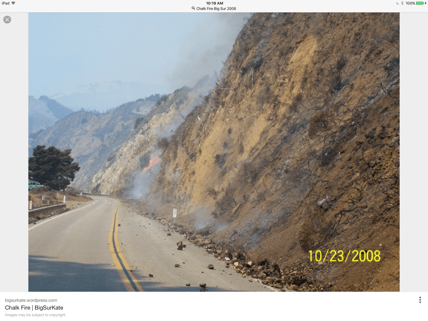
10:30 am – Since this fire first hit the national forest, the plan has been to hold it north of Nacimiento RD. Even today, on the situation report, that is the plan. In 2008, after the Basin Fire was finished, a new fire appeared on the South side of Nacimiento RD. In looking for info about that fire, I was referred back to my own blog … Hmmm…and was shown this photo:
9:00 am – Here is a slide show of some photos taken yesterday at Terrace Creek by Cordelia Cluett who lost the home she grew up in up Marble Peak in the 2008 Basin Fire. It provides a different perspective of the back burns yesterday. Thanks, Cordelia
From the Post Ranch looking East toward Ventana Inn of the back burn operation yesterday. Photo by Jeffrey Carmichael

7:00 am – Big Sur Valley is a bit on edge today, as communities usually are in front of a firing operation. The smoke is drifting down this direction more than it did yesterday, but still not as bad as it looked in town. Busy waiting for report ins from others, and checking on things, but hopefully, those in Big Sur Valley will start sharing their views, thoughts, and experiences after morning coffee. Until then, sent last night by Michael Minasian of Big Sur Center, taken at 5:50 pm at 27,000′


 Operations Map North:


